
Length 122 km | ||
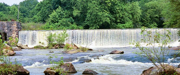 | ||
The Yellow River is a 76-mile-long (122 km) tributary of the Ocmulgee River in the U.S. state of Georgia.
Contents
Map of Yellow River, Georgia, USA
The river rises north of Lawrenceville in Gwinnett County and flows south through the outer eastern suburbs of Atlanta, passing through the easternmost corner of DeKalb County before entering Rockdale County. Continuing south into Newton County, the river joins the South River in Lake Jackson, 2 miles (3 km) upstream of the junction of the Alcovy River to form the Ocmulgee River.
Recreation
Yellow River Park is a highly vegetated area located off Juhan Road in the city of Stone Mountain, Georgia - just southeast of the granite dome of Stone Mountain. The 566-acre (229 ha) park includes a 12-mile (19 km) trail that can be used for walking, hiking, and horse riding. The park has pavilions, grills, and a large playground, as well as a wooden overlook that provides a view of the Yellow River. Some people walk down to the river using an unmarked trail to wade in the river, or tube down the river to Norris Lake, although this is not encouraged by Gwinnett County or Yellow River Regional Park.