
Country Vietnam Impounds Krong Poko Installed capacity 720 MW Opened 1996 | Opening date 1996 Surface area 64.5 km (24.9 sq mi) Height 69 m Construction began 1993 | |
 | ||
Similar Sơn La Dam, Cathedral of Kontum, Hòa Bình Dam, Khu du lịch sinh thái thác Phú, Buôn Kuốp Hydroelectric Power St | ||
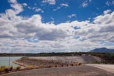
The Yali Falls Dam is the second largest dam in Vietnam, located in Gia Lai and Kon Tum provinces on the Krong Poko, a tributary of the Sesan River, in the Central Highlands of Vietnam, about 70 kilometres (43 mi) upstream of the Cambodian border. The 69-metre (226 ft)-high dam was begun in 1993 and sealed in 1996, with the 64.5 square kilometres (24.9 sq mi) reservoir filled by 1998. It aims to generate 720 MW of hydropower.
Like many large dam projects, it has been highly criticised, for causing flooding, damaging fisheries and for the lack of consultation with Cambodian authorities. Amongst those opposing the dam are the Sesan-Srepok-Sesong Protection Network (3SPN), organising 59 villages in northeast Cambodia to promote the environment in the three river basins and supported by Oxfam.