
Population 2,717 (2011 census) | Postcode(s) 6330 Postal code 6330 | |
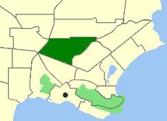 | ||
Location 2 km (1 mi) NE of Albany | ||
Yakamia is an inner suburb of Albany. The suburb was created in the 1970s, and was gazetted in 1979. The name is believed to be a Noongar Aboriginal word meaning "sister to a small creek".
Contents
Map of Yakamia WA 6330, Australia
Geography
Yakamia is bounded by North Road to the south, Chester Pass Road to the west, Hudson and Bond Roads to the north and Ulster Road to the southeast. Yakamia Creek runs through the suburb.
Facilities
Yakamia is a residential suburb, and used to consist primarily of bushland, however, this has slowly disappeared with the bush making way for new housing developments. The suburb contains Yakamia Primary School, which opened in 1970 and now has around 620 students. There is also a small shopping centre on North Road. The City of Albany's council offices are located in Yakamia along North Road.