
Native name L'Yères (f) Length 40 km | Basin size 327 km (126 sq mi) Basin area 327 km² Mouth English Channel | |
 | ||
Main source Aubermesnil-aux-Érables220 m (720 ft) Discharge Average rate:2.7 m (8 ft 10 in) | ||
The Yères is a river of Normandy, France, 40 kilometres (25 mi) in length, flowing through the department of Seine-Maritime
Geography
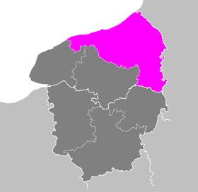
The river’s source is in the forest of Eu, just south of the village of Aubermesnil-aux-Érables. Its course takes a northerly route past Foucarmont and Fallencourt. It then turns northwestward and passes through the communes of Grandcourt, Villy-sur-Yères, Sept-Meules, Cuverville-sur-Yères, Saint-Martin-le-Gaillard, Touffreville-sur-Eu and finally through Criel-sur-Mer to the sea.
Like most other rivers in the region, the Yères is classified as a first class river, offering anglers the chance to catch trout and lampreys, but not salmon.
References
Yères Wikipedia(Text) CC BY-SA