
Mouth Bass Strait Mouth elevation 0 | ||
 | ||
Regions South East Coastal Plain (IBRA), The Otways | ||
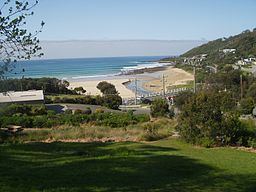
The Wye River is a perennial river of the Corangamite catchment, located in The Otways region of the Australian state of Victoria.
Contents
Map of Wye River, VIC, Australia
Location and featuresEdit
The Wye River rises in the Otway Ranges in southwest Victoria and flows generally east towards the town of Wye River where the river reaches its mouth and empties into Bass Strait, north of Cape Otway. From its highest point, the river descends 601 metres (1,972 ft) over its 11-kilometre (6.8 mi) course.
EtymologyEdit
The river was named by surveyor George Smythe and is derived from one of the rivers of the same name in the United Kingdom.
References
Wye River (Victoria) Wikipedia(Text) CC BY-SA