
Postcode(s) 4305 Postal code 4305 | Population 855 (2011) | |
 | ||
State electorate(s) Electoral district of Ipswich West | ||
Wulkuraka is a suburb of Ipswich, Queensland, Australia. At the 2011 Australian Census the suburb recorded a population of 855.
Contents
Map of Wulkuraka QLD 4305, Australia
History
The origin of the suburb name is from an Aboriginal word meaning either red flowering gum tree or plenty of kookaburras.
The Brisbane Valley railway line once joined the Main Line from the north at Wulkuraka.
Heritage listings
Wulkuraka has a number of heritage-listed sites, including:
Transport
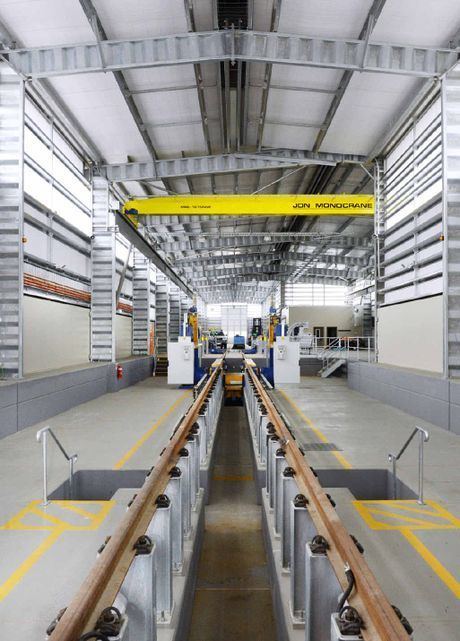
Wulkuraka Railway Station provides Queensland Rail City network services to Rosewood, Ipswich and Brisbane via Ipswich. A purpose built workshop has been constructed to the west of the railway station, exclusively for the New Generation Rollingstock. 75 of these new trains will be serviced and maintained there under the Qtectic consortium.
Wulkuraka is located approximately 1 hours drive to Brisbane. It is located near Royal Australian Air Force Base, Amberley. It is in close vicinity of shops and services, however is undeveloped and located on the outer suburbs of Ipswich. Wulkuraka is a peaceful suburb with large bushland topography.