
Area rank 70 of 105 Lowest elevation 137 m (449 ft) Area 17.25 km² | Canton Grevenmacher Highest elevation 355 m (1,165 ft) Time zone CET (UTC+1) Local time Thursday 5:58 AM | |
 | ||
Weather 3°C, Wind N at 13 km/h, 89% Humidity Points of interest Musée et Maison du Vin, Duhr Frères ‑ Clos Mon, Winery Jeff Konsbrück, Max‑Lahr et Fils, Caves Ley‑Schartz & Fils | ||
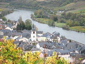
Wormeldange (Luxembourgish: Wuermeldeng, German: Wormeldingen) is a commune and small town in eastern Luxembourg. It is part of the canton of Grevenmacher, which is part of the district of Grevenmacher.
Map of Wormeldange, Luxembourg
As of 2005, the town of Wormeldange, which lies in the south of the commune, has a population of 742. Other towns within the commune include Ahn, Ehnen, Machtum, and Wormeldange-Haut.
References
Wormeldange Wikipedia(Text) CC BY-SA