
Country United Kingdom | ||
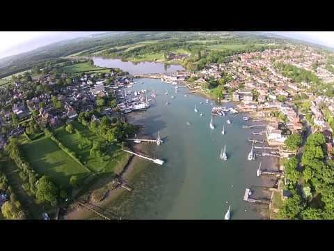 | ||
Wootton Creek is a tidal estuary that flows into the Solent on the north coast of the Isle of Wight.
Map of Wootton Creek, United Kingdom
On the west bank of the creek is the village of Wootton, whilst on the east bank is the village of Fishbourne. The estuary is bridged by the main Ryde to Newport road, where there once was a tide mill. The estuary is not navigable south of the bridge, and tide controls means that water is retained south of the bridge most of the time.
On the side of the estuary there is a Forestry Commission woodland called "Firestone Copse" which is about 30 acres (120,000 m2) in size.
The estuary has also been known in the past as "Fishbourne Creek", "Wootton River" and "Wootton Haven". At the mouth of the estuary is the Wightlink car ferry terminal for connections to Portsmouth.
Since 1993 Wootton Creek and the adjacent Ryde Sands have been designated as SSSIs due to their wide range of intertidal sand flats.