
OS grid reference SO451983 Dialling code 01694 | Civil parish Woolstaston Sovereign state United Kingdom | |
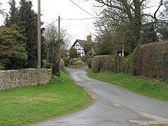 | ||
Woolstaston is a small village and civil parish in Shropshire, England, south of Shrewsbury and north of the nearest town, Church Stretton.
Map of Woolstaston, Church Stretton, UK
It is located in the northern foothills of the Long Mynd and is situated near Leebotwood, Smethcott and Picklescott. The parish is geographically very small, covering only the village, the lanes leading to it and a small part of the Walkmills area to the north-east. The area also contains the Rectory Farm Bed & Breakfast.
References
Woolstaston Wikipedia(Text) CC BY-SA