Girish Mahajan (Editor)

Woodpark, New South Wales

Updated on
Edit
Like
Comment
Share on FacebookTweet on TwitterShare on LinkedInShare on Reddit
Postcode(s)
  
2164

Postal code
  
2164

Federal division
  
Division of Blaxland

LGA(s)
  
Cumberland Council

Woodpark
  
Guildford West

State electorate(s)
  
Fairfield

Population
  
1,324 (2011 census)

Woodpark, New South Wales httpsuploadwikimediaorgwikipediacommonsthu

Location
  
29 km (18 mi) west of Sydney CBD

Woodpark is a suburb of Sydney, in the state of New South Wales, Australia. Woodpark is located 29 kilometres west of the Sydney central business district in the local government area of the Cumberland Council.

Contents

Map of Woodpark NSW 2164, Australia
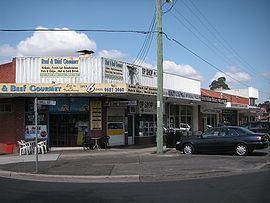
Commercial area

Woodpark contains a small row of convenience stores and a petrol station near the main road, and two stops on the T-way bus system. There is a park across the road from the shops.

Demographics

  • The most common ancestries in Woodpark were Australian 21.5%, English 13.7%, Lebanese 12.3%, Irish 5.2% and Italian 4.2%.
  • 56.2% of people only spoke English at home. Other languages spoken at home included Arabic 17.2%, Hindi 2.9%, Cantonese 2.4%, Italian 2.3% and Greek 2.0%.
  • 66.7% of people were born in Australia. The most common countries of birth were Lebanon 4.8%, New Zealand 2.9%, Fiji 2.3%, Philippines 1.5% and England 1.4%.
  • The most common responses for religion were Catholic 45.1%, Anglican 16.1%, Islam 8.3%, No Religion 6.7% and Eastern Orthodox 6.3%.
  • References

    Woodpark, New South Wales Wikipedia