
Surface area 9 km (3.5 sq mi) Settlements Lake Country Area 9 km² Volume 0.1995 km³ | Average depth 21.5 m (71 ft) Surface elevation 391 m Catchment area 190 km² Max. depth 34 m (112 ft) Shore length1 13.5 km (8.4 mi) | |
 | ||
Water volume 0.1995 km (161,700 acre·ft) | ||
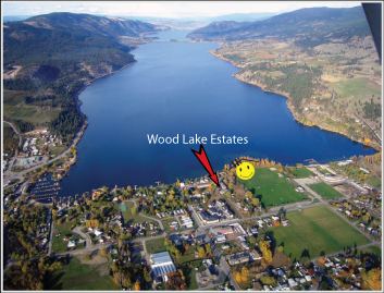
Wood Lake is a lake in a chain of five major lakes which occupies portions of the Okanagan Valley in the interior of British Columbia, Canada. The lakes of the Okanagan Valley were formed by about 8900 BP. Wood Lake is immediately south of Kalamalka Lake and in 1908 was connected to it by a dredged channel (the Oyama canal). Situated between Oyama and Winfield, it has a solid reputation for rainbow trout fishing. The lake is named after Tom Wood, who settled on the south end of the lake around 1860.
Contents
Map of Wood Lake, Lake Country, BC, Canada
The dry climate and suitable soil has encouraged development of a substantial tree fruit industry around the lake and throughout the valley. The upper watershed is heavily forested and has been logged for several decades. The lower elevation of the watershed is described as a Ponderosa pine/bunchgrass area.
Physical data
There is also a Wood Lake in Fraser Valley, an area of British Columbia.