
 | ||
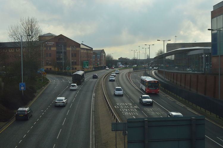
The city of Wolverhampton, West Midlands, England has a Ring Road which encircles the city centre. It is around 2 miles (3.2 km) in circumference. Technically, the route is listed as an "Inner Ring Road", although only a tiny section of the "Outer Ring Road" was ever constructed, while only one of the two designed carriageways exist.
Map of A4150, Wolverhampton WV1, UK
It is divided into seven sections, between seven junctions with nearly all of the main routes into the city. The seven sections are all named after saints (e.g. "Ring Road St John's"). Originally the names chosen referred to nearby churches; however, with one section still to be built, it was noticed that St George, St Andrew and St Patrick (the patron saints of England, Scotland and Ireland respectively) were included, but St David (of Wales) was not. Thus the final section was named after St David, but not for any local reason.
Clockwise from the south-west corner, the sections are as follows:
Two main roads into the city do not meet the Ring Road, these being the A454 Compton Road from the west and the A460 Cannock Road from the north-east; they meet the A41 and A449 respectively slightly further away from the Ring Road, but within 1⁄4 mi (0.40 km) in each case.
The Ring Road was constructed in stages between 1960 and 1986. The St John's and St Mark's sections were the first to be built in the 1960s. The St David's section to was the final section to be completed, and passes under a bridge connecting the east of the city centre to Wolverhampton railway station. It was built as a dual carriageway with very wide central reservations to allow for future grade separation of the junctions, which has never happened. As a result, most of the road has a very green appearance, except for Ring Road St Mark's which has a car park in the centre, reached by an underpass from the city centre.
It officially carries the designation A4150, although this does not appear on any signs with the exception of at the junction of Waterloo Road and Jack Hayward Way, near to Molineux stadium, and not on the Ring Road itself.
The southern section of the ring road was home to Josef Stawinoga, a Polish immigrant known locally as "Fred the Tramp". He set up home in a tent on the ring road's central reservation soon after it opened in the 1960s, and lived there until his death in October 2007 at the age of 86.