
Postcode(s) 2550 Local time Wednesday 1:45 PM State electorate(s) Bega Population 380 (2006 census) | Postal code 2550 Lga Bega Valley Shire Federal division Division of Eden-Monaro | |
 | ||
Weather 20°C, Wind E at 18 km/h, 54% Humidity | ||
Wolumla is an historical locality in New South Wales, Australia and is between Bega and Merimbula. Wolumla is a small rural village located off the Princes Highway to the south of Bega. Wolumla is located on rolling hills on the coastal hinterland near the headwaters of Frogs Hollow Creek and has been predominantly cleared for beef, dairy and sheep grazing. At the 2006 census, Wolumla had a population of 380.
Map of Wolumla NSW 2550, Australia
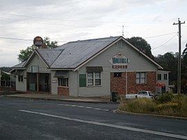
The township receives a small holiday population during peak holiday periods. The township consists of predominantly low density urban housing with a very small commercial area located on the main street consisting of a hotel, hair dresser, and general store including a post office agency. Also The Carpet Place established in 2009.
Wolumla is the home town of Australian rugby league international representative footballer, Matt McCoy.
Gold was discovered very near Wolumla in 1896.
Wolumla has a public school with kindergarten to year 6, which was established in 1882.