
- land 1.4 sq mi (4 km) Population 2,718 (2013) | - summer (DST) EDT (UTC-4) Local time Tuesday 1:47 AM | |
 | ||
- water 0.01 sq mi (0 km), 0.71% Weather 8°C, Wind E at 16 km/h, 92% Humidity | ||
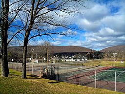
Wind Gap (Pennsylvania Dutch: Gratdaal) is a borough in Northampton County, Pennsylvania, United States. Wind Gap is located in the Lehigh Valley region of the state. It is part of Pennsylvania's Slate Belt.
Contents
Map of Wind Gap, PA 18091, USA
The population of Wind Gap was 2,720 at the 2010 census.
Geography
Wind Gap is located at 40°50′47″N 75°17′30″W (40.846429, -75.291631).
According to the United States Census Bureau, the borough has a total area of 1.4 square miles (3.6 km2), of which 0.73% is water.
Wind Gap is located 21 miles (34 km) north of Allentown in the Lehigh Valley and 50 miles (80 km) southeast of Scranton, in the Wyoming Valley or the Scranton/Wilkes-Barre metropolitan area.
Wind Gap's elevation is 755 feet (230 m) above sea level.
Demographics
As of the census of 2000, there were 2,812 people, 1,221 households, and 765 families residing in the borough. The population density was 2,061.8 people per square mile (798.3/km2). There were 1,294 housing units at an average density of 948.8 per square mile (367.4/km2). The racial makeup of the borough was 97.62% White, 0.46% African American, 0.04% Native American, 0.68% Asian, 0.53% from other races, and 0.68% from two or more races. Hispanic or Latino of any race were 1.60% of the population.
There were 1,221 households, out of which 26.6% had children under the age of 18 living with them, 49.4% were married couples living together, 10.2% had a female householder with no husband present, and 37.3% were non-families. 30.9% of all households were made up of individuals, and 13.4% had someone living alone who was 65 years of age or older. The average household size was 2.25 and the average family size was 2.84.
In the borough the population was spread out, with 20.8% under the age of 18, 7.5% from 18 to 24, 29.6% from 25 to 44, 22.8% from 45 to 64, and 19.2% who were 65 years of age or older. The median age was 39 years. For every 100 females there were 88.6 males. For every 100 females age 18 and over, there were 84.6 males.
The median income for a household in the borough was $35,030, and the median income for a family was $46,681. Males had a median income of $36,735 versus $22,700 for females. The per capita income for the borough was $21,239. About 7.2% of families and 11.9% of the population were below the poverty line, including 20.3% of those under age 18 and 9.8% of those age 65 or over.
Public education
The borough is served by the Pen Argyl Area School District.