
Legislature House of Commons District webpage profile, map Area (km²) 21 Province Ontario Elector 74,205 District created 1976 Population (2011) 109,680 | First contested 1979 Electors (2015) 74,205 Pop. density (per km²) 5,222.9 Census division Toronto MP Ali Ehsassi; Liberal Last contested 2015 | |
 | ||
Willowdale is a federal electoral district in Toronto, Ontario, Canada. It has been represented in the Canadian House of Commons since 1979.
Contents
For a long time this riding was considered a Liberal stronghold, having been won by the Liberal Party of Canada in all but one election since 1980. Longtime Liberal MP Jim Peterson was the riding's MP from 1980 to 1984 and from 1988 to 2007, and Martha Hall Findlay was the riding MP from 2008 to 2011. Long considered a safe Liberal seat, Conservative candidate Chungsen Leung won by 932 votes on the May 2, 2011 federal election. In the 2015 federal election, the seat returned to the Liberal Party with Ali Ehsassi unseating Leung.
This district is home to some landmarks like Mel Lastman Square, the Toronto Centre for the Arts and the Claude Watson School for the Arts.
Geography
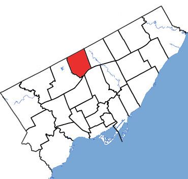
Consisting of that part of the City of Toronto described as follows: commencing at the intersection of the northerly limit of said city with Bayview Avenue; thence southerly along said avenue to Highway No. 401; thence generally southwesterly along said highway to the Don River West Branch; thence generally northwesterly along said branch to Bathurst Street; thence northerly along said street to the northerly limit of said city; thence easterly along said limit to the point of commencement.
The riding contains the neighbourhoods of Willowdale, Lansing, Newtonbrook and North York Centre.
Demographics
According to the Canada 2011 Census; 2013 representationEthnic groups: 39.5% White, 22.9% Chinese, 10.3% Korean, 9.7% West Asian, 4.9% Filipino, 4.5% South Asian, 2.2% Black, 1.7% Arab, 1.0% Latin American
Languages: 35.7% English, 19.1% Chinese, 9.8% Persian, 9.2% Korean, 5.8% Russian, 2.6% Tagalog, 1.7% Italian, 1.6% Spanish, 1.3% French, 1.2% Arabic
Religions: 46.0% Christian (20.6% Catholic, 4.3% Christian Orthodox, 3.2% Presbyterian, 2.4% United Church, 2.4% Anglican, 1.8% Baptist, 6.5% Pentecostal, 11.3% Other), 11.6% Muslim, 6.6% Jewish, 2.9% Buddhist, 1.8% Hindu, 30.4% No religion
Median income (2010): $26,200
Average income (2010): $42,045
History
The riding was created in 1976 from part of Eglinton, York North and York Centre.
Willowdale consisted initially of the part of the Borough of North York bounded on the north by the borough limit (Steeles Avenue), on the West by the West Branch of the Don River and Bathurst Street, on the south by Highway 401, and on the east by Bayview Avenue.
In 1987, it was redefined to consist of the part of the City of North York bounded on the north by the borough limits (Steeles Avenue), and on the east, south and west by a line drawn from the borough limit southeast along the Don River West Branch, south along Bayview Avenue, east along Finch Avenue East, south along the Don River East Branch, west along Highway 401, and northwest along the Don River West Branch to the borough limit.
In 1996, it was redefined to consist of the part of the City of North York bounded on the north by the borough limits (Steeles Avenue), and on the east, south and west by a line drawn from the borough limit south along the eastern limit of the city, west along the hydro-electric transmission line situated south of McNicoll Avenue, south along Highway 404, west along Finch Avenue East, south along the Don River East Branch, west along Highway 401, northwest along the Don River West Branch, north along Bathurst Street, east along Drewry Avenue, north along Chelmsford Avenue, west along Greenwin Village Road, and north along Village Gate to the northern city limit.
In 2003, it was redefined to consist of that part of the City of Toronto described as follows: commencing at the intersection of the northerly limit of said city with Victoria Park Avenue; thence southerly along said avenue to the hydroelectric transmission line situated northerly of Apache Trail; thence southwesterly along said transmission line to Highway No. 404; thence southerly along said highway to Finch Avenue East; thence generally westerly along said avenue to Leslie Street; thence southerly along said street to Highway No. 401; thence generally southwesterly along said highway to the Don River West Branch; thence generally northwesterly along said branch to Bathurst Street; thence northerly along said street to the hydroelectric transmission line situated northerly of Finch Avenue West; thence generally easterly along said transmission line to Yonge Street; thence northerly along said street to the northerly limit of said city; thence easterly along said limit to the point of commencement.
This riding lost territory (36%) to Don Valley North, and gained territory from York Centre (16%) during the 2012 electoral redistribution.
Members of Parliament
This riding has elected the following Members of Parliament:
Election results
Note: Conservative vote is compared to the total of the Canadian Alliance vote and Progressive Conservative vote in 2000 election.
Note: Canadian Alliance vote is compared to the Reform vote in 1997 election.