
Architect Sharp, Albert Area 8 ha Added to NRHP 18 December 1990 | NRHP Reference # 90001911 Local time Monday 12:55 PM | |
 | ||
Location Properties around Willington Common and E on Tolland Tnpk. pt Old Farms Rd., Willington, Connecticut Architectural style Mid 19th Century Revival, Colonial, Federal Weather 13°C, Wind W at 5 km/h, 39% Humidity | ||
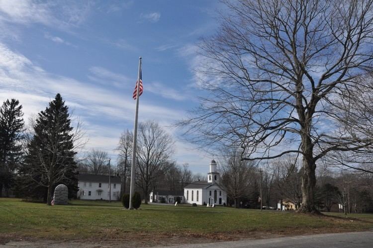
Willington Common Historic District is a historic district that includes the town green, Willington Common, of the town of Willington, Connecticut. The common and the surrounding buildings were listed on the National Register of Historic Places in 1990.
Map of Willington Hill, Willington, CT 06279, USA
The district is located at the junction of Route 74 and Route 320, on the location now known as Willington Hill, which is the original settlement and town center of Willington. The Green is rectangular and is bounded by Route 74 on the south, Jared Sparks Road on the east and Common Road on the north and west.
The buildings around the common were built in the 18th and 19th centuries. They include two churches, the Old Town Hall, a parsonage and other residences (some of which served as stores and taverns). The two churches are the most dominant structures on the Green. The historic district covers an area of 19 acres and comprises 32 buildings, sites, and objects. It is noted primarily for its architecture, including designs by Albert Sharp.