
 | ||
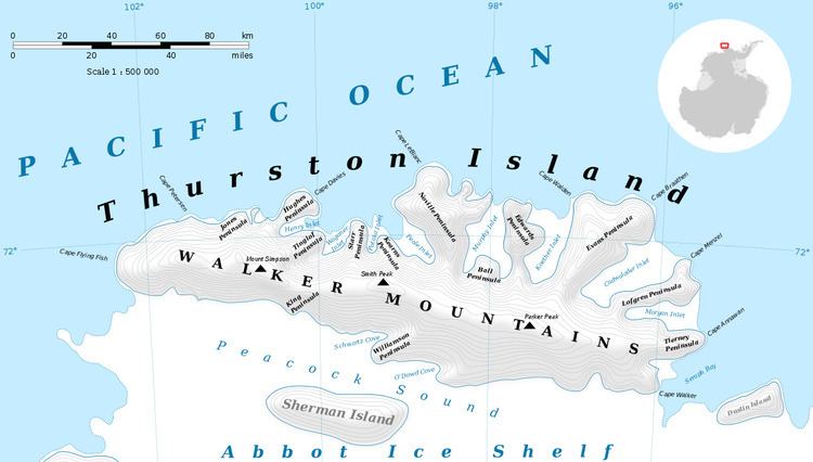
Williamson Peninsula (72°27′S 99°18′W) is an ice-covered peninsula midway along the south side of Thurston Island. It extends southwest into Abbot Ice Shelf between Schwartz Cove and O'Dowd Cove. Named by Advisory Committee on Antarctic Names (US-ACAN) after Lieutenant Commander H. E. Williamson, Medical Officer of the seaplane tender Pine Island in the Eastern Group of U.S. Navy Operation Highjump, 1946-47.
Maps
This article incorporates public domain material from the United States Geological Survey document "Williamson Peninsula" (content from the Geographic Names Information System).
References
Williamson Peninsula Wikipedia(Text) CC BY-SA