
Architectural style Town lattice truss Area 4,000 m² | NRHP Reference # 73000216 Added to NRHP 28 August 1973 | |
 | ||
Address North Hartland, VT 05052, USA Similar Cornish Bridge, Taftsville Covered Bridge, Middle Covered Bridge, Blow‑Me Bridge, Covered Bridge Real Estate | ||
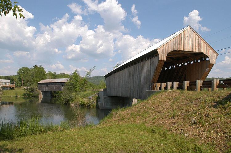
The Willard Covered Bridge is a historic covered bridge carrying Mill Street across the Ottauquechee River in Hartland, Vermont. It is the eastern of two covered bridges on the road, which are connected via a small island in the river; the western bridge was built in 2001. This bridge, built about 1870, was listed on the National Register of Historic Places in 1973.
Description and history
The Willard Covered Bridge is located in the village of North Hartland, where Mill Street runs roughly eastward, crossing the Ottauquechee River to provide access to a few homes and businesses. The road crosses the river at a point south of Interstate 91 (I-91) where it is briefly bisected by a small island. The western of the bridges carrying the road is a modern covered bridge, while the Willard Bridge is to the east. It is a single-span Town lattice truss 123 feet (37 m) in length, resting on stone abutments faced in concrete. It is 21 feet (6.4 m) wide, with a roadway width of 16.5 feet (5.0 m) (one lane). The gable ends project beyond the trusses, and the roof is a standing seam metal roof. The bridge sides and portals are sheathed in vertical board siding; there are two square openings cut into each side.
The bridge was built about 1870; it is one of two surviving 19th-century covered bridges in Hartland. (The other is the Martin's Mill Covered Bridge, also listed on the National Register.)