
Length ca. 29 km (18 mi) | ||
 | ||
Main source E of Moide, on the Mathberg (87.5 m or 287 ft)83 m (272 ft) Tributaries Left:Aue, Reininger Moorgraben Towns and villages Wietzendorf, Reddingen, Halmern, Reiningen, Müden (Örtze) | ||
The Wietze is a river, 29 kilometres long, in the South Lüneburg Heath, in Lower Saxony, Germany.
Map of Wietze, Germany
The river rises east of the Soltau suburb of Moide and flows from there in a southerly direction to Wietzendorf. Here it is joined by the only tributary of any size, the Aue. The Aue has two source streams: the Hötzinger Aue, which rises north of Stübeckshorn, 98 m above sea level and the Alvernsche Aue, that has its source northwest of Alvern, 86 m above sea level. Beyond Wietzendorf the Wietze swings east, passes the village of Reddingen and flows through its attached hamlets of Halmern and Reiningen and past the Winterhoff farm. It then turns again towards the south and discharges into the Örtze at Müden.
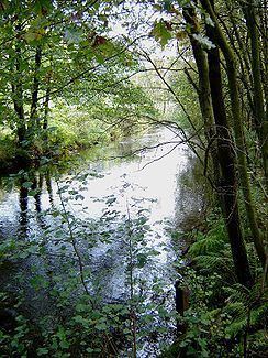
The Wietze is a very clean river. It is water quality class II through (moderately polluted, -betamesosaprob-) Between Wietzendorf and Velligsen the river can be used by canoes. It is looked after by the Örtze maintenance division which is based Faßberg.
There is a river of the same name that also flows through the Lüneburg Heath, but discharges into the River Aller - see Wietze (Aller).