
OS grid reference TL568706 Post town ELY Dialling code 01353 | Sovereign state United Kingdom Local time Sunday 6:29 PM | |
 | ||
Weather 14°C, Wind NW at 8 km/h, 64% Humidity | ||
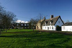
Wicken is a small village on the edge of The Fens near Soham in East Cambridgeshire, ten miles north east of Cambridge and five miles south of Ely. It is the site of Wicken Fen National Nature Reserve.
Contents
Map of Wicken, UK
History
Wicken parish consists principally of fenland covering 1,604 hectares (3,964 acres) in eastern Cambridgeshire. Its western border largely follows the course of the River Cam, and its southern border separating it from Burwell follows the winding Wicken Lode, which flows into Reach Lode just before the latter meets the Cam. A fenland waterway forms its eastern border with Soham parish. Since at least the 10th century the parish has also contained the hamlet of Upware in its isolated south-west corner on the Cam.
East Cambridgeshire is known for its great quantity of archaeological findings from the Stone Age, the Bronze Age and the Iron Age. Of Wicken some Bronze Age activity is known as there are a few subsided barrows. Stone Age flint tools, Bronze Age weapons and Roman coinage have also been found in the parish as well as a few spears and other weapons from the Anglo-Saxon era.
Wicken's relative isolation and poverty has meant that several of the late medieval and early modern timber-framed houses survive. The medieval limestone cross which formerly stood on Cross Green was unburied and reinstated there in 1973.
Wicken was listed as Wicha in the Domesday Book and Wiken in around 1200. The name comes from an Old-English dative plural wícum meaning "the dwellings" or "the trading settlement".
Wicken also has the last 12 sided Smock windmill in England which has been restored to working use by an enthusiastic team of volunteers.
The War Memorial
Near the village green there is a War Memorial to the men of the area who died in the two World Wars. The name of Bailey is sadly prominent, with three in the First World War and one in the Second World War. There is also a mention of the 50th anniversary of the Women's Institute (1959).
The church
The church is dedicated to Saint Laurence and is situated at the eastern end of the village. The newer centre of the village is now some distance away. The church has a nave with three bays, a north and south aisle, a tower that contains five bells, a chancel, a south porch and a large vestry on the north side of the tower. The present building is largely 14th century, with some 13th century stonework.
Interred under the altar are Henry Cromwell, fourth son of Oliver Cromwell along with his wife, some of their children and an unidentified Elizabeth Cromwell.
Village life
The village's only public house, The Maid's Head, so named since the mid-18th century, occupied a 15th-century thatched hall house, extended to the west in 1852, until it was hit by a fire in 1983. The building was rebuilt immediately to its original design. Former pubs include The Red Lion, recorded from the late 18th century until it closed in the 1930s, and the Black Horse at the top of Lode Lane, which closed by the 1950s. Upware retains the Five Miles from Anywhere Inn by the river.
The village faces the larger settlement of Soham across a flat expanse of agricultural land, once flooded, and still called Soham Mere.