
Established 1847 Local time Sunday 3:09 PM | Municipality Enoch Mgijima Postal code (street) 5360 | |
 | ||
Weather 31°C, Wind NW at 23 km/h, 20% Humidity | ||
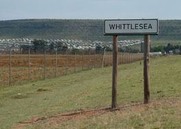
Whittlesea (formerly known as Bulhoek) is a settlement situated 37km south of Queenstown, Eastern Cape Province. It includes the townships of Dongwe and Sada. Whittlesea now lays claim to the first registered wine estate in the Eastern Cape.
Contents
Map of Whittlesea, 5360, South Africa
Hewu Hospital (formerly operated by Lifecare, but provincialized since 2010) is to be found only 4 km on the road to Ekuphumleni Township.
It was founded in 1849 and became a defence outpost in the Frontier War of 1850-1853. Named after Whittlesea in Cambridgeshire, birthplace of Sir Harry Smith (1787-1860), Governor of the Cape Colony from 1847 to 1852.
Villages
Some of the villages surrounding Whittlesea include;
References
Whittlesea, Eastern Cape Wikipedia(Text) CC BY-SA