
Country United States Area code(s) 715 & 534 Elevation 249 m Population 1,584 (2013) | Time zone Central (CST) (UTC-6) FIPS code 55-86725 Area 7.25 km² Local time Sunday 5:45 AM | |
 | ||
Weather 1°C, Wind NE at 2 km/h, 79% Humidity | ||
Whitehall wisconsin
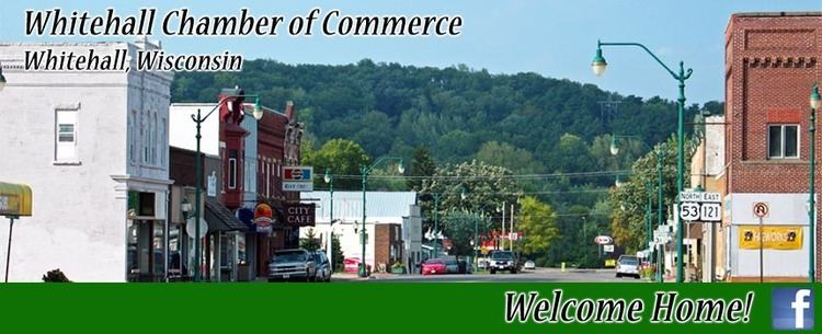
Whitehall is a city in Trempealeau County, Wisconsin, United States, along the Trempealeau River. The population was 1,558 at the 2010 census. It is the county seat of Trempealeau County.
Contents
Map of Whitehall, WI 54773, USA
Like the nearby cities of Arcadia, Independence, and Blair, Whitehall is located on the former Green Bay and Western Railroad, which ran down the Trempealeau River valley to Winona, Minnesota.
History
A post office called Whitehall was first established in 1861. The city was named after White Hall, Illinois.
Geography
According to the United States Census Bureau, the city has a total area of 2.80 square miles (7.25 km2), all of it land.
2010 census
As of the census of 2010, there were 1,558 people, 665 households, and 382 families residing in the city. The population density was 556.4 inhabitants per square mile (214.8/km2). There were 741 housing units at an average density of 264.6 per square mile (102.2/km2). The racial makeup of the city was 96.9% White, 0.4% African American, 0.1% Native American, 0.4% Asian, 1.5% from other races, and 0.6% from two or more races. Hispanic or Latino of any race were 4.2% of the population.
There were 665 households of which 27.4% had children under the age of 18 living with them, 43.8% were married couples living together, 9.5% had a female householder with no husband present, 4.2% had a male householder with no wife present, and 42.6% were non-families. 36.4% of all households were made up of individuals and 16.5% had someone living alone who was 65 years of age or older. The average household size was 2.24 and the average family size was 2.92.
The median age in the city was 42 years. 23.2% of residents were under the age of 18; 7.6% were between the ages of 18 and 24; 22.7% were from 25 to 44; 26.7% were from 45 to 64; and 19.7% were 65 years of age or older. The gender makeup of the city was 48.8% male and 51.2% female.
2000 census
As of the census of 2000, there were 1,651 people, 693 households, and 415 families residing in the city. The population density was 991.2 people per square mile (381.7/km²). There were 733 housing units at an average density of 440.1 per square mile (169.5/km²). The racial makeup of the city- fairly typical for its locality- was 99.64% White, 0.12% African American, 0.06% Native American, 0.06% Asian, 0.06% from other races, and 0.06% from two or more races. Hispanic or Latino of any race were 0.30% of the population.
There were 693 households out of which 29.9% had children under the age of 18 living with them, 48.3% were married couples living together, 8.5% had a female householder with no husband present, and 40.0% were non-families. 35.6% of all households were made up of individuals and 20.6% had someone living alone who was 65 years of age or older. The average household size was 2.25 and the average family size was 2.95.
In the city, the population was spread out with 23.7% under the age of 18, 6.7% from 18 to 24, 26.3% from 25 to 44, 21.4% from 45 to 64, and 21.9% who were 65 years of age or older. The median age was 40 years. For every 100 females there were 92.4 males. For every 100 females age 18 and over, there were 89.5 males.
The median income for a household in the city was $33,958, and the median income for a family was $48,047. Males had a median income of $28,643 versus $21,332 for females. The per capita income for the city was $17,743. About 4.1% of families and 7.3% of the population were below the poverty line, including 7.3% of those under age 18 and 7.6% of those age 65 or over.