
Country United States FIPS code 30-80050 Elevation 1,537 m Zip code 59645 Local time Sunday 1:32 AM | Time zone Mountain (MST) (UTC-7) GNIS feature ID 0793216 Area 2.62 km² Population 970 (2013) Area code 406 | |
 | ||
Weather 6°C, Wind W at 16 km/h, 64% Humidity | ||
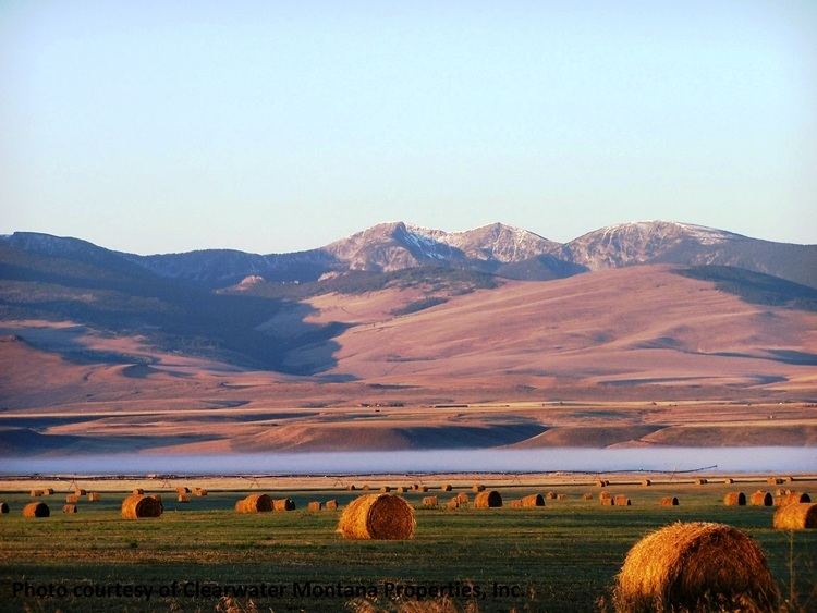
White Sulphur Springs is a city in and the county seat of Meagher County, Montana, United States. The population was 939 at the 2010 census.
Contents
- Map of White Sulphur Springs MT 59645 USA
- Geography and climate
- 2010 census
- 2000 census
- Notable residents
- References
Map of White Sulphur Springs, MT 59645, USA
The center of population of Montana is located in White Sulphur Springs.
Geography and climate
White Sulphur Springs is located at 46°32′47″N 110°54′9″W (46.546396, -110.902552).
According to the United States Census Bureau, the city has a total area of 1.01 square miles (2.62 km2), all land.
2010 census
As of the census of 2010, there were 939 people, 433 households, and 255 families residing in the city. The population density was 929.7 inhabitants per square mile (359.0/km2). There were 563 housing units at an average density of 557.4 per square mile (215.2/km2). The racial makeup of the city was 97.2% White, 0.1% African American, 0.3% Native American, 0.4% Asian, 0.2% from other races, and 1.7% from two or more races. Hispanic or Latino of any race were 1.4% of the population.
There were 433 households of which 22.2% had children under the age of 18 living with them, 49.4% were married couples living together, 7.9% had a female householder with no husband present, 1.6% had a male householder with no wife present, and 41.1% were non-families. 37.4% of all households were made up of individuals and 19.6% had someone living alone who was 65 years of age or older. The average household size was 2.13 and the average family size was 2.75.
The median age in the city was 51.2 years. 19% of residents were under the age of 18; 5.1% were between the ages of 18 and 24; 18% were from 25 to 44; 31.4% were from 45 to 64; and 26.3% were 65 years of age or older. The gender makeup of the city was 49.8% male and 50.2% female.
2000 census
As of the census of 2000, there were 984 people, 443 households, and 265 families residing in the city. The population density was 1,069.1 people per square mile (413.0/km²). There were 567 housing units at an average density of 616.0 per square mile (238.0/km²). The racial makeup of the city was 96.24% White, 1.42% Native American, 0.20% Asian, 0.10% Pacific Islander, 0.51% from other races, and 1.52% from two or more races. Hispanic or Latino of any race were 1.93% of the population.
There were 443 households out of which 25.3% had children under the age of 18 living with them, 48.1% were married couples living together, 8.4% had a female householder with no husband present, and 40.0% were non-families. 37.0% of all households were made up of individuals and 17.8% had someone living alone who was 65 years of age or older. The average household size was 2.16 and the average family size was 2.84.
In the city, the population was spread out with 22.4% under the age of 18, 6.9% from 18 to 24, 22.5% from 25 to 44, 26.9% from 45 to 64, and 21.3% who were 65 years of age or older. The median age was 44 years. For every 100 females there were 94.9 males. For every 100 females age 18 and over, there were 92.9 males.
The median income for a household in the city was $28,229, and the median income for a family was $34,342. Males had a median income of $23,403 versus $13,929 for females. The per capita income for the city was $13,836. About 11.6% of families and 13.3% of the population were below the poverty line, including 16.5% of those under age 18 and 11.0% of those age 65 or over.