
Country United States County Oakland ZIP codes 48383, 48386 Elevation 292 m Population 30,019 (2010) | Time zone Eastern (EST) (UTC-5) Area code(s) 248 Local time Sunday 1:51 AM | |
 | ||
Weather 3°C, Wind SW at 6 km/h, 77% Humidity Area 96.35 km² (87.28 km² Land / 9.065 km² Water) | ||
White Lake Charter Township is a charter township of Oakland County in the U.S. state of Michigan. Together with its two unincorporated communities, and the township makes up part of the Detroit metropolitan area outskirts. As of the 2010 census, the township population was 30,019.
Contents
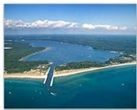
- Map of White Lake Charter Township MI USA
- Communities
- Geography
- Demographics
- Government
- Recreation
- References
Map of White Lake Charter Township, MI, USA
The Huron River rises in White Lake Township.
Communities
The Township has three unincorporated communities:
Geography
According to the United States Census Bureau, the township has a total area of 37.2 square miles (96 km2), of which 33.7 square miles (87 km2) is land and 3.5 square miles (9.1 km2), or 9.44%, is water.
Several of the community's large parcels have been preserved as state recreation areas and county parks. Rural residential development and lake living is typical, as the township has 21 lakes within its borders.
Intersected by M-59, a majority of the township's commercial development has occurred along this major east-west corridor.
The southernmost area of the township is located 19 miles (30 km) northwest of the Detroit city limits, and 10 miles (20 km) from downtown Pontiac.
Demographics
As of the census of 2000, there were 28,219 people, 10,092 households, and 7,821 families residing in the township. The population density was 838.3 per square mile (323.7/km²). There were 10,616 housing units at an average density of 315.4 per square mile (121.8/km²). The racial makeup of the township was 96.56% White, 0.78% African American, 0.49% Native American, 0.59% Asian, 0.02% Pacific Islander, 0.29% from other races, and 1.28% from two or more races. Hispanic or Latino of any race were 1.81% of the population.
There were 10,092 households out of which 39.0% had children under the age of 18 living with them, 65.0% were married couples living together, 8.7% had a female householder with no husband present, and 22.5% were non-families. 17.6% of all households were made up of individuals and 4.5% had someone living alone who was 65 years of age or older. The average household size was 2.77 and the average family size was 3.15.
In the township the population was spread out with 27.7% under the age of 18, 6.8% from 18 to 24, 32.8% from 25 to 44, 24.9% from 45 to 64, and 7.8% who were 65 years of age or older. The median age was 36 years. For every 100 females there were 100.1 males. For every 100 females age 18 and over, there were 99.1 males.
The median income for a household in the township was $65,894, and the median income for a family was $75,842. Males had a median income of $52,276 versus $31,742 for females. The per capita income for the township was $27,916. About 1.9% of families and 3.1% of the population were below the poverty line, including 3.0% of those under age 18 and 3.2% of those age 65 and over.
Government
The Township is served by five public school districts: Clarkston, Holly, Huron Valley, Walled Lake and Waterford.
Recreation
The nearby Highland Recreation Area offers many recreational activities with trails to accommodate equestrian riders, mountain bikers, hikers and skiers. Three different day-use areas provide ample space for picnics, swimming, horseshoes or volleyball. Access sites are located on four lakes within the park for fishing and recreational boating. Located within it now is Haven Hill, the Edsel Ford estate, designed by renowned landscape architect Jens Jensen between 1922 and 1935. Haven Hill is designated as a Michigan State Historical Landmark and a State Natural Preserve. Jensen's landscape elements, with the diversity of tree, plant and animal life, combine aesthetics, history and nature. The town is home to a ski resort known as Alpine Valley. This was opened in 1961 and has been open since. This resort is host to multiple lifts with a range of runs available. There are also terrain parks.
There are several other public and private parks and lakes that provide recreation to residents and non-residents. Pontiac Lake State recreation area offers public boat access and is partly in White Lake Township. Pontiac Lake is home to the annual "Quake on the Lake" hydroplane races. White Lake (the lake) also has public access. The township is also home to several parks with public golf courses, including White Lake Oaks and Indian Springs Metropark.