
Location Foxe Basin Nunavut Nunavut Population 0 | Highest point 1,100 m (3,609 ft) Region Qikiqtaaluk Area 789 km² | |
 | ||
Island group Canadian Arctic Archipelago | ||
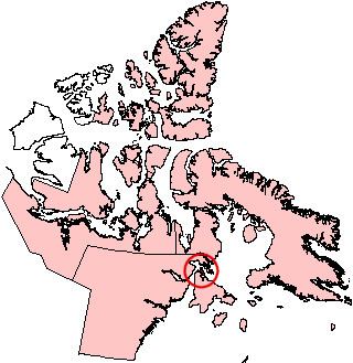
White Island is one of the uninhabited Canadian arctic islands in Kivalliq Region, Nunavut, Canada. Located in Foxe Basin off the northern tip of Southampton Island, it measures 789 km2 (305 sq mi) in area.
Map of White Island, Nunavut, Canada
White Island is separated from Southampton Island by the narrow (less than 2 km) Comer Strait to the west, and Falcon Strait to the south. There are several capes including Cape Middleton, Cape Frigid, and Cape Deas. Whale Sound and Toms Harbour are on the eastern coast, and Frozen Strait is just beyond. White Island is surrounded by several small islands including Passage Island, Whale Island, Seekoo Island, Nas Island, as well as many that are unnamed. The highest peaks are 1,100 m (3,609 ft) and 1,000 m (3,281 ft). While the island is strewn with lakes, the largest is 17 km (11 mi) long.