
OS grid SD673587 Elevation 544 m | Topo map OS Landranger 103 Prominence 159 m Listing Marilyn | |
 | ||
Similar Wolfhole Crag, Easington Fell, Hawthornthwaite Fell, Fair Snape Fell, Longridge Fell | ||
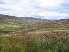
White Hill is a hill in the Forest of Bowland, north-western England. It lies between Slaidburn and High Bentham. The summit houses a tower and a trig point. In medieval times, the hill marked one of the northernmost limits of the Lordship of Bowland.
Map of White Hill, Lancaster, UK
References
White Hill (Forest of Bowland) Wikipedia(Text) CC BY-SA