
Country United States County Morris FIPS code 20-77825 Elevation 448 m Local time Saturday 11:34 PM Area code 785 | Time zone Central (CST) (UTC-6) GNIS feature ID 0476888 Zip code 66872 Population 596 (2013) | |
 | ||
Weather 7°C, Wind E at 11 km/h, 92% Humidity Area 3.263 km² (3.237 km² Land / 3 ha Water) | ||
Hey whatever happened to jim sharp of white city kansas
White City is a city in Morris County, Kansas, United States. As of the 2010 census, the city population was 618.
Contents
- Hey whatever happened to jim sharp of white city kansas
- Map of White City KS USA
- History
- Geography
- Climate
- 2010 census
- 2000 census
- Transportation
- Education
- References
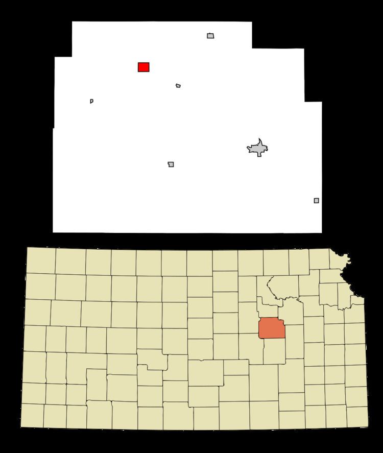
Map of White City, KS, USA
History
White City was founded in 1871 by a colony from Chicago. It was named for F. C. White, a railroad official.
The first post office in White City was established in January 1872.
In 1887, the Chicago, Kansas and Nebraska Railway built a main line from Topeka through White City to Herington. The Chicago, Kansas and Nebraska Railway was foreclosed in 1891 and taken over by Chicago, Rock Island and Pacific Railway, which shut down in 1980 and reorganized as Oklahoma, Kansas and Texas Railroad, merged in 1988 with Missouri Pacific Railroad, merged in 1997 with Union Pacific Railroad. Most locals still refer to this railroad as the "Rock Island".
Geography
White City is located at 38°47′43″N 96°44′12″W (38.795216, -96.736657). According to the United States Census Bureau, the city has a total area of 1.26 square miles (3.26 km2), of which, 1.25 square miles (3.24 km2) is land and 0.01 square miles (0.03 km2) is water.
Climate
The climate in this area is characterized by hot, humid summers and generally mild to cool winters. According to the Köppen Climate Classification system, White City has a humid subtropical climate, abbreviated "Cfa" on climate maps.
2010 census
As of the census of 2010, there were 618 people, 238 households, and 169 families residing in the city. The population density was 494.4 inhabitants per square mile (190.9/km2). There were 279 housing units at an average density of 223.2 per square mile (86.2/km2). The racial makeup of the city was 95.3% White, 0.8% African American, 1.1% Native American, 0.3% Asian, 1.3% from other races, and 1.1% from two or more races. Hispanic or Latino of any race were 2.1% of the population.
There were 238 households of which 34.0% had children under the age of 18 living with them, 55.5% were married couples living together, 10.5% had a female householder with no husband present, 5.0% had a male householder with no wife present, and 29.0% were non-families. 25.2% of all households were made up of individuals and 13.4% had someone living alone who was 65 years of age or older. The average household size was 2.60 and the average family size was 3.05.
The median age in the city was 39.2 years. 26.4% of residents were under the age of 18; 8.1% were between the ages of 18 and 24; 23.6% were from 25 to 44; 27.3% were from 45 to 64; and 14.6% were 65 years of age or older. The gender makeup of the city was 50.8% male and 49.2% female.
2000 census
As of the census of 2000, there were 518 people, 218 households, and 149 families residing in the city. The population density was 416.3 people per square mile (161.3/km²). There were 253 housing units at an average density of 203.3 per square mile (78.8/km²). The racial makeup of the city was 95.37% White, 0.77% African American, 0.19% Native American, 0.19% Asian, 1.16% from other races, and 2.32% from two or more races. Hispanic or Latino of any race were 2.32% of the population.
There were 218 households out of which 34.4% had children under the age of 18 living with them, 56.4% were married couples living together, 9.2% had a female householder with no husband present, and 31.2% were non-families. 27.5% of all households were made up of individuals and 15.1% had someone living alone who was 65 years of age or older. The average household size was 2.38 and the average family size was 2.91.
In the city, the population was spread out with 26.8% under the age of 18, 6.4% from 18 to 24, 28.2% from 25 to 44, 21.8% from 45 to 64, and 16.8% who were 65 years of age or older. The median age was 37 years. For every 100 females there were 97.0 males. For every 100 females age 18 and over, there were 101.6 males.
The median income for a household in the city was $36,136, and the median income for a family was $39,423. Males had a median income of $29,000 versus $18,000 for females. The per capita income for the city was $14,603. About 5.7% of families and 7.2% of the population were below the poverty line, including 8.8% of those under age 18 and 7.5% of those age 65 or over.
Transportation
White City is connected to the Union Pacific rail system.
Education
White City is part of Unified School District 481. The community is served by a pre-kindergarten through grade 12 school with a mascot of Huskies.