
Country Canada Regional District Metro Vancouver Province British Columbia | Region Lower Mainland Time zone PST (UTC-8) Mayor Linda Hepner | |
 | ||
City Surrey, British Columbia Restaurants Sushi & Roll, Taste Of Punjab, Bubble 88, Fresgo Inn Restaurant, All About Pho Hotels Days Inn Surrey, Surrey Central Inn, Compass Point Inn, THE FLAMINGO HOTEL, Civic Hotel - Autograph Collection | ||
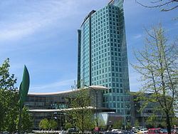
Whalley is the city centre of Surrey, British Columbia and is the most densely populated and urban of Surrey's six town centres. It is the only town centre currently serviced by tracked rapid transit (SkyTrain Expo Line via Scott Road, Gateway, Surrey Central and King George stations) and is home to the SFU Surrey campus within the Central City Shopping Centre, the main shopping centre in Whalley.
Contents
Map of Whalley, Surrey, BC, Canada
Based on City of Surrey Population Estimates and Projections, Whalley is the second most populous community in Surrey next to Newton Town Centre.
History
As early as the 1880s, people began settling what is now present-day Whalley.
The municipal council in 1908 requested a grant to construct a roadway from Fraser Bridge to present-day 108 Avenue. This provided a much safer path to the river compared to the steep, winding Old Yale Road, and the new road later became part of the King George Highway.
In 1925, Arthur Whalley moved his family from Cloverdale to a three-acre triangle of land at the future intersection of Ferguson Road (108 Avenue), Grosvenor Road and the King George Highway. After clearing the land and spending their first winter in tents, they built a service station, which included a general store, soft drink stand, and tourist cabins.
The community officially adopted the name of Whalley in 1948, after the board of trade held a contest to rename what had become known as “Whalley’s Corner”. “Binnieville” had also been recommended, in honour of Tom Binnie, a local real estate and insurance broker who had fostered Whalley’s growth as a commercial centre.
In the mid-20th century, Whalley saw numerous debates regarding its secession from Surrey to become a separate city or municipality. In 1976, Metro Vancouver (then known as the GVRD) identified Whalley as one of four regional town centres, sparking off revitalization of the town centre. The City of Surrey adopted the “Whalley-Guildford Plan” in 1985, proposing high-density commercial development along 104 Avenue between the Whalley and Guildford areas.
Government
Whalley is represented in the Legislative Assembly of British Columbia by the Surrey-Whalley riding and in the Canadian House of Commons by the Surrey North riding. Randeep Sarai is Whalley's Member of Parliament, and Bruce Ralston is the MLA.
Crime
Whalley is generally regarded as the most dangerous part of the lower mainland and is notorious for its crime. In recent years, Newton has rivalled Whalley for the reputation of being the most dangerous part of Surrey.
Events
Attracting 15,000 people every February since 2004, WinterFest is a day of live music, sporting activities, food, and fireworks, held at the Central City Plaza.
Due in part to having one of British Columbia's youngest populations, with nearly one-third of all citizens under 18, Surrey has become known for its annual Children's Festival, which began 2004. The free, multi-day festival features circus and clay arts, world rhythm music and movement, popular children's performers, storytelling sessions, and a parade.
In 2008, the City, thanks to the federal government's designation of Surrey as Canada's Cultural Capital for the year, put on a three-day multicultural festival. The Fusion Festival celebrated over 60 different cultures through food, music, and dance. The event attracted 60,000 attendees,
Whalley is also home to the city’s Annual Christmas Tree Lighting Festival. Previously held at Holland Park, it was moved to Central City Mall plaza. Whalley also welcomes the annual parade of lights in 2011, which used to be held only in Cloverdale.