
Population 6,026 (2011 census) LGA(s) City of Fairfield Postal code 2164 | Postcode(s) 2164 Area 11.2 km² | |
 | ||
Location 34 km (21 mi) west of Sydney CBD | ||
Wetherill Park is a suburb of Sydney, in the state of New South Wales, Australia. Wetherill Park is located 34 kilometres west of the Sydney central business district, in the local government area of the City of Fairfield and is part of the Greater Western Sydney region.
Contents
- Map of Wetherill Park NSW 2164 Australia
- Aboriginal culture
- White settlement
- Street names
- Commercial areas
- Transport
- Schools
- Parks and recreation
- Places of worship
- Notable residents
- References
Map of Wetherill Park NSW 2164, Australia
The 2011 census recorded that Wetherill Park as having a resident population of 6,026. Just under half (47.5%) of these residents were born in Australia. The area is 11.2 km2. Most residents live in the south-east corner, the larger portion of the suburb being an industrial area.
Wetherill Park sits on the southern border of Prospect Reservoir.
Aboriginal culture
Aboriginal people from the Cabrogal clan of the Gandangara tribe, have lived in the area for more than 30,000 years.
White settlement
Wetherill Park was named after a businessman who offered 21 acres (85,000 m2) of his property to the State government as a park. The offer was accepted and the park was named after the donor. The first settlers in set up their homes north of the present school site at Wetherill Park. One hundred years ago, there were not enough homes in this suburb to need a school.
With the commencement of the Prospect Reservoir Waterworks, a local storekeeper, Samuel Booth, made available a section of his land for a school, free of charge. The school, called 'Macquarie Park', was located on the corner of Victoria and Daniel Streets being 365 Victoria Street, Wetheril Park. It opened in May 1882 with 8 children but it was changed in June 1882 to 'Boothtown' for Samuel Booth’s involvement in the establishment of the school. In 1884 it became Reservoir Public School and in 1896, it became the Wetherill Park Public School. In 1986 the school made way for the Phuoc Hue Temple, and was relocated down the road to Lily Street and renamed William Stimson Public School, in honour of the first mayor of the City of Fairfield.
Street names
A characteristic of Wetherill Park is that all the streets are named after famous writers. Some examples include: Vidal Street (for Gore Vidal), Shakespeare Street (for William Shakespeare), Stevenson Street (for Robert Louis Stevenson), Locke Street (for John Locke), Gogol Place (for Nikolai Gogol), Swinburne Crescent (for Richard Swinburne), Homer Place (for Homer), Emerson Street (for Ralph Waldo Emerson), Wordsworth Street (for William Wordsworth), Dickens Road (for Charles Dickens), Longfellow Street (for Henry Wadsworth Longfellow), Chaucer Street (for Geoffrey Chaucer), Ainsworth Crescent (for William Harrison Ainsworth), Coleridge Road (for Samuel Taylor Coleridge), Frost Close (for Robert Frost), Gissing Street (for George Gissing), Maugham Crescent for Somerset Maugham and Langland Street (for William Langland).
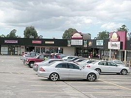
Commercial areas
Stockland Wetherill Park is a major shopping centre in the area and features one of Australia's largest cinema complexes owned by Hoyts. The shopping centre opened in 1983 and in recent years, underwent major renovations.
Wetherill Park Shopping Centre (now known as Market Town) opened in the early 1980s on the corner of The Horsley Drive and Rossetti Street, adjacent to Emerson Street Reserve tennis courts. It originally featured approximately 25 specialty shops, including a Franklins supermarket. In recent years, the shopping centre underwent renovations which saw the shopping complex completely reformed, and the rear parking lot expanded. Today, the complex also features a bowling centre.
Wetherill Park is home to the largest industrial estate in the Southern Hemisphere, with companies such as Jaguar, BMW, Subaru and Mercedes-Benz situated in the area. Despite the heavy industrial presence, the suburb maintains a coppice environment dominated by eucaluptus trees.
Transport
The T-Way bus route opened in 2003 and runs partly through Wetherill Park. It is also located close to the Westlink M7 Sydney Orbital motorway. The Horsley Drive is the major road which runs through Wetherill Park. Other major roads include Polding Street and Victoria Street.
Schools
Parks and recreation
The suburb features a large recreational park and an urban forest, Wetherill Park Nature Reserve. Adjacent to that Reserve is the Emerson Street Reserve, which is a 6-hectare, rectangular-shaped sports ground which features a walking track, a tennis facility, a skate park, a basketball court, cricket practice nets and a soccer field.
As part of Fairfield City Council's Parks Improvement Program, Shakespeare Park was upgraded in 2006.
Places of worship
Wetherill Park is home to a large Buddhist temple which was visited by Prince Charles in 1994.
Notable residents
Wetherill Park was once home to famous Italian footballer, Christian Vieri.