
Country Canada Time zone AST (UTC-4) Area 3,662 km² Local time Saturday 9:23 AM | Established 1785 Area code(s) 506 Population 144,158 (2011) | |
 | ||
Weather -4°C, Wind N at 8 km/h, 77% Humidity | ||
Beaumont falls westmorland county new brunswick canada part 2
Westmorland County (2011 population 144,158) is a county in New Brunswick, a province of Canada. It is in the south-eastern part of the province. It contains the fast-growing commercial centre of Moncton and its northern and eastern suburbs. Also located in the county are the university town of Sackville and the tourist destination of Shediac.
Contents
- Beaumont falls westmorland county new brunswick canada part 2
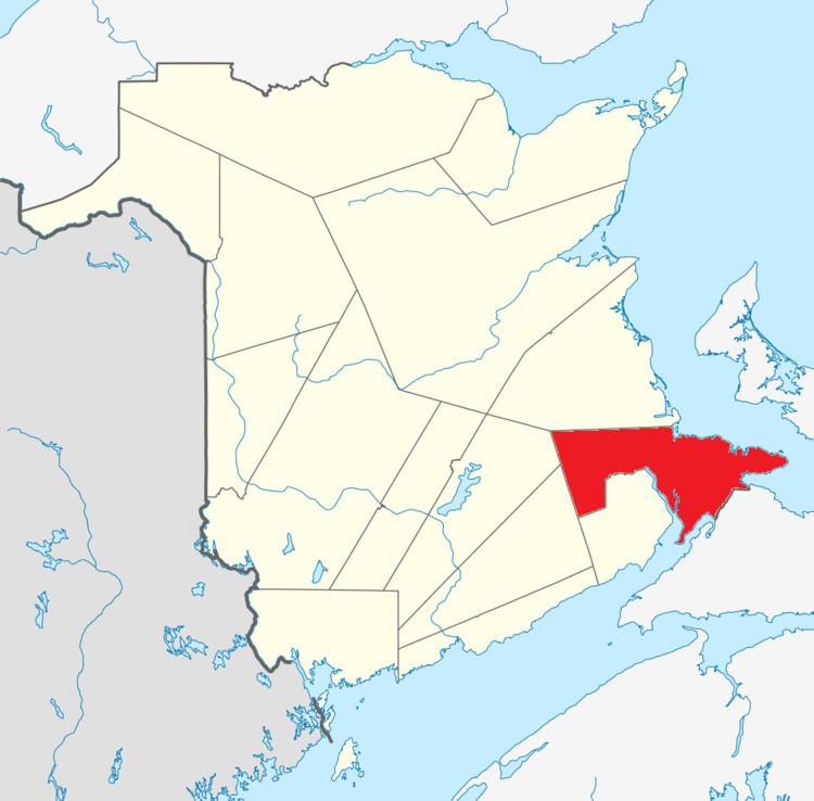
- Map of Westmorland County NB Canada
- Major Highways
- Communities
- First Nations
- Parishes
- Access Routes
- References
Map of Westmorland County, NB, Canada
Westmorland County is centrally located in the Maritimes and is New Brunswick's most populous county. Fishing and tourism are important industries along the Northumberland Strait shore while there is some mixed farming in the Petitcodiac River Valley and in the Tantramar Marsh region. The city of Moncton accounts for half the county's population and has developed as a major transportation, distribution, commercial and retail centre. Dorchester is the historical shire town of the county.
Major Highways
Communities
There are eleven municipalities within Westmorland County (listed by 2011 population):
First Nations
There is one First Nations reservation in Westmorland County (listed by 2011 population):
Parishes
The county is subdivided into seven parishes (listed by 2011 population):
Access Routes
Highways and numbered routes that run through the county, including external routes that start or finish at the county limits: