
Country United States Time zone Eastern (EST) (UTC-5) Elevation 464 m Population 518 (2010) | State New York FIPS code 36-81138 Zip code 14171 Area code 716 | |
 | ||
Area 3.976 km² (3.968 km² Land / 7,770 m² Water) | ||
West Valley is a hamlet in the Town of Ashford in Cattaraugus County, New York, United States. The population was 518 at the 2010 census, which lists the community as a census-designated place.
Contents
Map of West Valley, NY 14171, USA
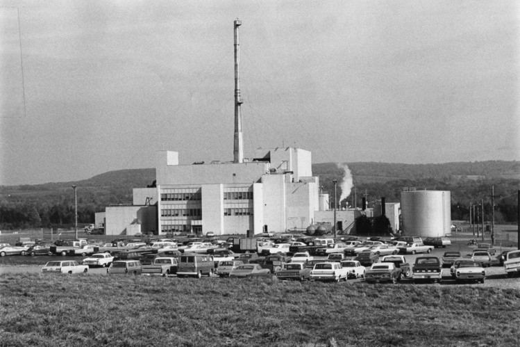
Located at the intersection of Cattaraugus County Route 53 and State Route 240/County Route 32, the hamlet is home to West Valley Central School and the West Valley Demonstration Project, a nuclear cleanup facility. Because of the presence of a school district, a telephone exchange (716-942), and a post office located in (and named after) the hamlet, many people mistake West Valley to be the name of an actual town or village. However, it does not have any autonomous government separate from the town of Ashford.
Geography
West Valley is located at 42°24′10″N 078°36′36″W (42.4028410, -78.6100253) and its elevation is 1,522 feet (464 m).
According to the 2010 United States Census, the CDP has a total area of 1.535 square miles (3.98 km2), of which 1.532 square miles (3.97 km2) is land and 0.003 square miles (0.01 km2) is water.