
Country Canada Established 1786 Population 731 (2011) | County Charlotte County Time zone AST (UTC-4) Province New Brunswick | |
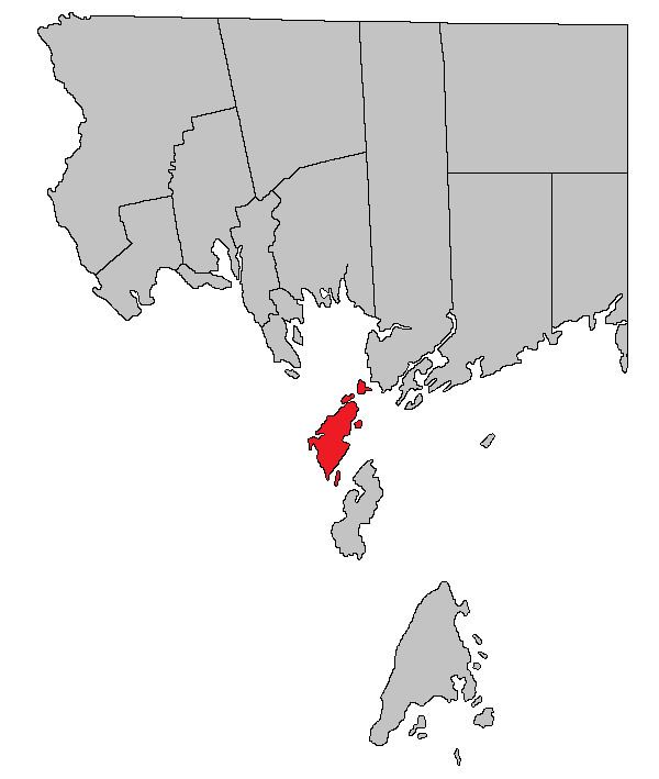 | ||
West Isles is a Canadian parish including Deer Island and numerous smaller islands in Charlotte County, New Brunswick.
Contents
- Map of West Isles NB Canada
- History
- Delineation
- Governance
- Communities
- Bodies of water Islands
- Access Routes
- References
Map of West Isles, NB, Canada
History
The West Isles Parish were established in 1786 to include Deer Island and adjacent islands: West Isles Parish included Campobello Parish until 1803 and Grand Manan Parish until 1816. The islands are part of the Fundy Islands.
Delineation
West Isles Parish is defined in the Territorial Division Act as being bounded:
To consist of Deer Island and the lesser islands contiguous to it, not included in the parishes before-mentioned.Governance
The entire parish forms the local service district of the parish of West Isles, established in 1970 to assess for fire protection. First aid and ambulance services were added in 1982 and recreational facilities in 1987. The LSD is often called Deer Island for its only inhabited island.
Communities
Parish population total does not include incorporated municipalities (in bold).
Bodies of water & Islands
This is a list of rivers, lakes, streams, creeks, marshes and Islands that are at least partially in this parish
Access Routes
Highways and numbered routes that run through the parish, including external routes that start or finish at the parish limits: