
OS grid reference TQ622880 Region East Sovereign state United Kingdom Population 1,482 (2001) District Borough of Brentwood UK parliament constituency Brentwood and Ongar | Civil parish West Horndon Country England Post town BRENTWOOD Shire county Essex Dialling code 01277 | |
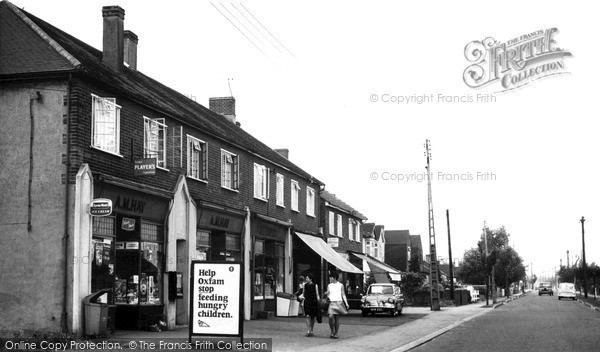 | ||
West Horndon is a civil parish in the Borough of Brentwood in Essex, England. Other than the village of West Horndon it also includes East Horndon, Dunton Hills and Little Warley. The local council of the parish is West Horndon Parish Council. Located approximately 21 miles east of London, it is a predominantly rural parish with some residential and light industrial development. There are large sections of open land used for agriculture and leisure. West Horndon parish was abolished in 1934 and created again in 2003 with new boundaries.
Contents
Map of West Horndon, UK
History
West Horndon was an ancient parish in the Barnstable hundred of Essex. It was grouped into the Billericay poor law union and rural sanitary district. It became part of Billericay Rural District in 1894. In 1934 the parish was abolished when it became part of Brentwood Urban District.
The parish abolished in 1934 was an elongated area stretching north—south in common with neighbouring parishes. East Horndon was a separate parish to the east and the next parish to the west was Little Warley. The population of West Horndon in 1931 was 147.
The civil parish formed in 2003, with significantly different boundaries, is perpendicular to the former parish, stretching east—west to incorporate territory formerly part of the parishes of Childerditch, Dunton, East Horndon, Little Warley and West Horndon. In each of these former parishes the inner part is now part of West Horndon and the northern and southern extremities (and eastern part for Dunton) is outside the parish.
Governance
The local council of the parish is West Horndon Parish Council. The parish council had existed before, from 1894 to 1934. The civil parish was created anew in 2003 following a petition by residents in 2002.
Geography
The parish includes the settlements of East Horndon, Dunton Hills, Little Warley and West Horndon. It is predominately a rural parish with large sections of open land within the Metropolitan Green Belt. Within the main settlement of West Horndon village are some streets of suburban houses and a small area of light industrial use. To the southeast of the parish is the Dunton Hills golf course. Little Warley in the northwest is the other main area of activity with some houses and the Clearview sports centre. East Horndon is a scattered settlement to the northeast and is partially located north of the A127 Southend Arterial Road. The entire parish is within the post town of Brentwood in the CM postcode area.
The entire southern boundary with the unparished borough of Thurrock is the London, Tilbury and Southend railway line, with a small deviation to include all of West Horndon railway station. The western boundary with the unparished area of Great Warley is the Mardyke river, where the parish touches the eastern Greater London boundary at North Ockendon. The northern boundary is partially formed by the Southend Arterial Road, with some land to the northeast of it included in the parish. The eastern boundary is with the Borough of Basildon.