
ZIP codes 10460 Area 38 ha | Borough Bronx Area code 718, 347, 646 Population 4,700 (2011) | |
 | ||
Restaurants EL Nuevo Valle #2, D' Kora Restaurant Lounge, Tropa Pizzaria, Chin Ming Chan Chinese, Chicken Seiri | ||
muninyc east tremont avenue boston road west farms bronx 10460
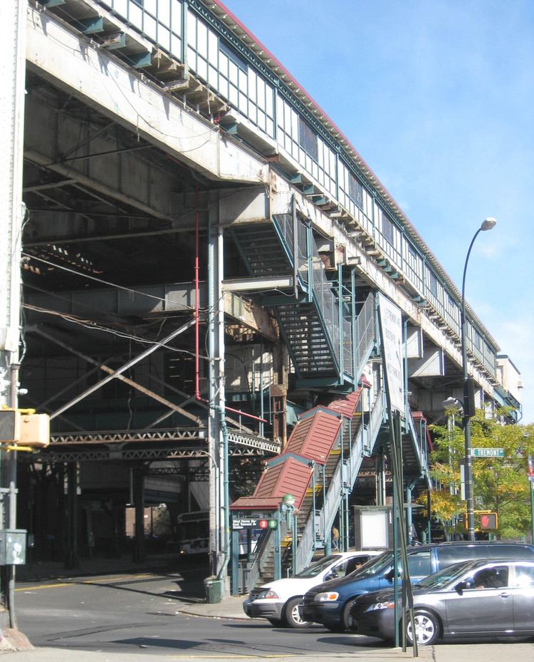
West Farms is a residential neighborhood in a west central part of The Bronx, New York City, also known as the northeast corner of the South Bronx. The neighborhood is part of Bronx Community Board 6. Its boundaries, starting from the north and moving clockwise are: Bronx Park to the north, the Bronx River Parkway to the east, the Cross-Bronx Expressway to the south, and Crotona Avenue to the west. East Tremont Avenue is the primary thoroughfare through West Farms. The local subway station is the IRT White Plains Road Line (2 5) at West Farms Square – East Tremont Avenue, operating along Boston Road and East 180th Street on Morris Park Avenue. Zip codes include 10460. The area is patrolled by the NYPD's 48th Precinct located at 450 Cross Bronx Expressway in East Tremont. NYCHA property in the area is patrolled by P.S.A. 8 at 2794 Randall Avenue in the Throggs Neck section of the Bronx.
Contents
- muninyc east tremont avenue boston road west farms bronx 10460
- Map of West Farms Bronx NY 10460 USA
- Demographics
- Land use and terrain
- History
- Social problems
- Schools
- Transportation
- References
Map of West Farms, Bronx, NY 10460, USA
Demographics
West Farms is a low-income neighborhood with a population of around 4,700.
The neighborhood predominately consists of Latin Americans and African Americans. West Farms has one of the highest concentrations of Puerto Ricans in New York City. Almost half the population lives below the poverty line and receives public assistance (AFDC, Home Relief, Supplemental Security Income, and Medicaid). The vast majority of households are renter occupied.
Land use and terrain
West Farms is dominated by 5 and 6-story tenement buildings, older multi-unit homes, vacant lots, and newly constructed subsidized attached multi-unit townhouses and apartment buildings. Most of the original housing stock was structurally damaged by arson and eventually razed by the city. The total land area is less than one square mile. The terrain is somewhat hilly.
The West Farms Bus Depot is located along East 177th Street next to a terminated Sheridan Expressway; it opened on September 7, 2003 on the site of the former Coliseum Depot.
There are two NYCHA developments located in West Farms.
- 1010 East 178th Street; a 21-story building.
- Twin Parks East (Site 9); a 14-story building.
History
West Farms was separated from the town of Westchester, New York, by an act of the legislature in 1846, formed from the settlements of West Farms, Morrisania, and Fordham, which survive as recognizable neighborhoods of The Bronx to this day. The patent of the "West Farms", which were the farthest western section of Westchester, were granted by letters patent in 1666 to Edward Jessup and John Richardson, both of Westchester, who had jointly purchased it "of the Indyan proprietors". It was bounded on the east by the "river commonly called by the Indians Aquehung, otherwise Broncke river" Jessup was dead within a year, and his widow conveyed his share to Thomas Hunt of Westchester, whose family is commemorated in the name of Hunts Point. In 1711, the heirs of the patentees joined in a second division of the lands in twelve lots with immutable boundaries, which were subsequently divided up. During the American Revolution numerous engagements occurred here; there were too few able-bodied men to form a company of continental militia, so West Farms formed a joint company with Fordham.
In 1848 the village of West Farms was described as "pleasantly situated at the head of the navigable waters of the Bronx, three miles from the East river, and twelve from New York". Though it was rapidly increasing in size, it already had about 1000 inhabitants, in about 200 houses.There were three district schools, for boys and girls, and a ladies' seminary and a boys' private school. The railroad depot of the Harlem & Westchester Rail Road stood a mile north of the village, where there were four churches, "4 taverns, a temperance house, 12 stores of different kinds, and a post office." In addition to seven sloops moored on the Bronx River, there were manufactories: a Brussels carpet and spinning factory, another carpet manufactory, and a grist mill and a lumber mill, formerly de Lancey's Mills, converting the last stands of timber accessible to the Bronx River upstream. Rail service to the city was on an almost hourly schedule, and West Farms was developing into a railroad suburb like Yonkers, which bounded it on the north. In 1848 the Hunt house (built in 1688) still stood on Hunts Point at the end of "Planting Neck", and the high ground along the neck was dotted with villas. Poet Joseph Rodman Drake found inspiration in the views of Long Island Sound and is buried nearby.
Social problems
For decades West Farms has been one of the poorest communities in America. Many social problems associated with poverty from crime to drug addiction have plagued the area for quite some time. Despite declines in crime from its peak during the crack and heroin epidemics, violent crime continues to be a serious problem in the community. West Farms has significantly higher drop out rates and incidents of violence in its schools than in other parts of the city. Other problems in local schools include low test scores and high truancy rates. Drug addiction is also a serious problem in the community. Due to the lucrative drug trade in the area many addicts reside in the community. Peer pressure among children who come from broken homes contributes to the high rate of usage.
Many households in the area are headed by a single mother which contributes to the high poverty rate. Many of them had their children at a very young age and could not provide for their children. Many of the families living in West Farms have been in poverty for generations. The incarceration rate in the area is also very high. Many if not most males in the community have been arrested at some point in their lives. This is related to the aggressive policing tactics, including "sweeps", that are used because of the area's high crime rate. West Farms is home to a significant number of inmates currently held in New York state prison and jail facilities.
Schools
Public:
Parochial: