
Country United States County Monmouth Time zone Eastern (EST) (UTC-5) Elevation 9 m Zip code 07719 | Area code(s) 732/848 Area 122 ha Population 2,493 (2010) | |
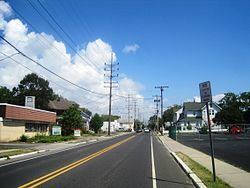 | ||
West Belmar is an unincorporated community and census-designated place (CDP) within Wall Township, in Monmouth County, New Jersey, United States. As of the 2010 United States Census, the CDP's population was 2,493.
Contents
Map of West Belmar, Belmar, NJ 07719, USA
Geography
According to the United States Census Bureau, the CDP had a total area of 0.470 square miles (1.216 km2), all of which was land.
Census 2010
The 2010 United States Census counted 2,493 people, 984 households, and 646.5 families residing in the CDP. The population density was 5,308.6 per square mile (2,049.7/km2). The CDP contained 1,092 housing units at an average density of 2,325.3 per square mile (897.8/km2). The racial makeup of the CDP was 91.01% (2,269) White, 0.60% (15) Black or African American, 0.60% (15) Native American, 1.56% (39) Asian, 0.00% (0) Pacific Islander, 5.09% (127) from other races, and 1.12% (28) from two or more races. Hispanics or Latinos of any race were 10.71% (267) of the population.
Out of a total of 984 households, 28.3% had children under the age of 18 living with them, 46.2% were married couples living together, 14.5% had a female householder with no husband present, and 34.3% were non-families. 27.0% of all households were made up of individuals, and 9.2% had someone living alone who was 65 years of age or older. The average household size was 2.53 and the average family size was 3.09.
In the CDP, 21.5% of the population were under the age of 18, 8.1% from 18 to 24, 27.8% from 25 to 44, 31.0% from 45 to 64, and 11.6% who were 65 years of age or older. The median age was 40.7 years. For every 100 females the census counted 93.9 males, but for 100 females at least 18 years old, it was 90.0 males.
Census 2000
As of the 2000 United States Census there were 2,606 people, 1,000 households, and 673 families residing in the CDP. The population density was 2,096.2/km2 (5,450.2/mi2). There were 1,096 housing units at an average density of 881.6/km2 (2,292.2/mi2). The racial makeup of the CDP was 95.47% White, 0.92% African American, 0.19% Native American, 1.27% Asian, 0.27% Pacific Islander, 0.84% from other races, and 1.04% from two or more races. Hispanic or Latino of any race were 2.57% of the population.
There were 1,000 households out of which 34.1% had children under the age of 18 living with them, 50.5% were married couples living together, 12.2% had a female householder with no husband present, and 32.7% were non-families. 27.7% of all households were made up of individuals and 9.7% had someone living alone who was 65 years of age or older. The average household size was 2.61 and the average family size was 3.21.
In the CDP the population was spread out with 26.2% under the age of 18, 7.0% from 18 to 24, 34.3% from 25 to 44, 22.1% from 45 to 64, and 10.3% who were 65 years of age or older. The median age was 36 years. For every 100 females there were 94.9 males. For every 100 females age 18 and over, there were 91.1 males.
The median income for a household in the CDP was $56,367, and the median income for a family was $60,144. Males had a median income of $46,458 versus $32,500 for females. The per capita income for the CDP was $22,276. About 4.5% of families and 3.1% of the population were below the poverty line, including 3.4% of those under age 18 and 6.5% of those age 65 or over.