
Population 146 (2011 Census) Civil parish Wervin Postcode district CH2 | OS grid reference SJ422719 Local time Monday 7:03 AM | |
 | ||
Unitary authority Weather 8°C, Wind NW at 21 km/h, 77% Humidity | ||
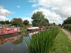
Wervin is a small village and civil parish in the unitary authority of Cheshire West and Chester and the ceremonial county of Cheshire, England. It is situated between Chester and Ellesmere Port, near the Shropshire Union Canal and the M53 motorway. At the 2001 Census, Wervin had a population of 118, increasing to 146 at the 2011 Census.
Map of Wervin, Chester, UK
The village was a township in St. Oswald's Parish of the Wirral Hundred, with a population of 56 in 1801, 60 in 1851, 94 in 1901 and 89 in 1951.
References
Wervin Wikipedia(Text) CC BY-SA