
Country United States County Wayne Time zone EST (UTC-5) Local time Sunday 12:21 PM Population 17,163 (2013) | Elevation 656 ft (200 m) Area code(s) 734 Zip code 48184 | |
 | ||
Weather 20°C, Wind S at 26 km/h, 33% Humidity | ||
Rotary club of wayne michigan
Wayne is a city in Wayne County in the state of Michigan, west of Detroit. As of the 2010 census, the city population was 17,593. Wayne has a long history of automotive and transportation related manufacturing. Ford Motor Company currently has two plants here; Wayne Stamping & Assembly and the Michigan Assembly Plant, formerly known as the Michigan Truck Plant.
Contents
- Rotary club of wayne michigan
- Map of Wayne MI 48184 USA
- History
- Urban Renewal
- Present
- Education
- Private Schools
- Community facilities
- Historical Museum
- Geography
- 2010 census
- 2000 census
- References
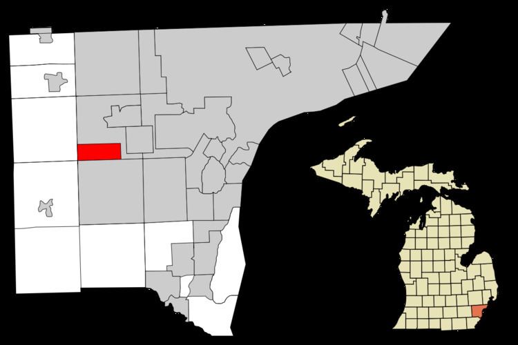
Map of Wayne, MI 48184, USA
History
The site of Wayne was crossed by the Sauk Trail, and due to this, the area was visited by Potawatomi and French fur traders for years before permanent settlement. The first settler was George M. Johnson, who built a small log cabin on 80 acres of land in 1824 (a state historical marker can now be found at the site). The cabin served as a tavern for travelers along the trail, by then known as the Chicago Road. The area soon became known as Johnson's Tavern. After a few years, the tavern was sold to Stephen G. Simmons, who continued to operate the business until he murdered his wife while in a drunken rage. Simmons was arrested and taken to Detroit, where he was tried and hanged September 24, 1830. He became the last person to be executed in Michigan, as the territory abolished capital punishment shortly thereafter.
In 1832, Ezra Derby bought the tavern and land from the Simmons heirs and began establishing a settlement. Derby built a sawmill, store, mill, blacksmith shop and the first frame dwelling for himself. In 1834 a plat was recorded in Detroit with lots and a town square under the name Derby's Corners. In 1836, the name of the settlement was changed to Wayne, in honor of Revolutionary War General Anthony Wayne. Soon a small hamlet began to develop, which was accelerated by the arrival of the Michigan Central Railroad in 1838. The Chicago Road that ran through Wayne was paved with oak logs in 1850, becoming the Detroit and Saline Plank Road. In 1867 it was changed to its current name of Michigan Avenue. In 1869, Wayne was incorporated as a village with a population of about 800 people. (In 1960 Wayne officially became a city.)
Many major industries have located in the village over the years. The Prouty and Glass Carriage Factory was the first, moving from Detroit in 1888. At the time, this made Wayne the largest carriage and sleigh producer in the country. In 1899, the Detroit interurban railroad (a streetcar system connecting Detroit to outlying towns) reached Wayne and ran until 1929. Ray Harroun, winner of the first Indianapolis 500, built the Harroun motor car in Wayne from 1916-21. The Gotfredson Truck was produced from 1924-27, and The Graham-Paige car company made vehicles in Wayne from 1928-36. Stinson Aircraft was also located at the nearby Detroit Industrial Airport and produced small planes from 1926-48. The Michigan Assembly Plant was built in 1957, and the Gar-Wood company built garbage trucks and hydraulic equipment from 1947-72. Other major companies located in Wayne include Unistrut and Wayne Industries.
The population and industrial production around Wayne significantly increased after World War II.
Urban Renewal
Beginning in the late 1950s Wayne began to consider a program of urban renewal for its residential and downtown areas. This would involve diverting Michigan avenue into two one-way roads that would circle the town, easing traffic through the narrow downtown area, and re-routing Wayne road with an "S" curve through town. This was paired with federal money for urban renewal, and it was decided to tear down most of the historic downtown area for redevelopment. Between 1964 and 1972, 77 acres of homes, businesses and buildings were leveled in central Wayne. Several entire streets were removed for the project. The reinvestment and businesses that the city hoped would come never materialized at the end of the project, and it took almost 40 years for the cleared area to fill in with new buildings.
Present
In the 1970s and 80s Wayne entered a bust period, having torn down most of its downtown in urban renewal the city was in financial difficulties. The 1990s and early 2000s brought a boom period however, with many new civic and community buildings and events. The city hosted an annual "Wheelfest" to celebrate its automotive history. In 2006 Downtown Wayne began to undergo a revitalization & growth program, with the assistance of Andrews University - Urban Design Studio. Completed projects have included the new fire station on Wayne Road, the new police station on Michigan Avenue, and the new Department of Public Works on Forest. Also in 2006, the Downtown Development Authority launched several beautification projects including streetscape and parking lot improvements and three City-operated hiking trails which border the city. Wayne is also a member of the Michigan Main Street program, a nonprofit entity that aims to revitalize down towns across the state. Main street has helped with several beautification projects in downtown and aims to attract new businesses.
Education
The Wayne-Westland Community School District operates public schools serving the city. Schools with attendance boundaries including the Wayne city limits include:
Elementary Schools:
Private Schools
All residents are zoned to Adams Upper Elementary School in Westland, Benjamin Franklin Middle School in Wayne, and Wayne Memorial High School in Wayne.
The sole early childhood campus serving the district is the Stottlemyer Early Childhood and Family Development Center in Westland.
Community facilities
Library - The Wayne Public Library was founded in 1923 in the back of a shoe store. The book collection was the personal property of the librarian who loaned them to Wayne residents. After occupying several other locations over the years, the library became an operation shared by the cities of Wayne and Westland and occupied a 5,000 sq ft (460 m2) building at Wayne and Sims roads which for many years served a combined population of over 100,000. In 1995, Wayne built its own 24,000 sq ft (2,200 m2). prairie-style library building at Veterans’ Plaza. The library offers books, CDs, DVDs, computer services, children's programming, and other special programs. The Friends of the Wayne Public Library provides supplemental financial support through their book sales and other programs. The semi-autonomous Wayne Library Board comprises five members appointed by City Council.
Parks - Wayne is home to 17 neighborhood parks and playgrounds. An annual fireworks display takes place at Attwood Park, and the annual Wheelfest celebration is held at Goudy Park. In the summer, the Goudy Park Concert Series is held each Thursday evening at the Park Amphitheater.
Community Center - The community center has an aquatic area, ice skating facility, Racquet & Exercise Club (REC), and the Oakbridge Suites Banquet Facility.
Senior Center - The Senior Center is located at the corner of Wayne and Sims Roads and offers programs to those 50 years and older. Programs include free Legal Aid, the Home Chore Program, free Blood Pressure checks, Meals on Wheels, Telecare services, the Golden Hour Club, Tai Chi, Bingo, Special Gadabout Van Trip, Sometimes Travelers, Now Showing Movies, Computer classes and many other special events.
Historical Museum
The Historical Museum is located at One Town Square, downtown Wayne, in the old village hall. The two-story red brick building was constructed in 1878 and was used as the first town hall until 1926. With some additions, the building then became the police and fire station until the early 1950s. In 1964 it was decided to turn the building into a history museum about the town. In 1986 a large addition was added to the museum by the Wayne Historical Society with no cost to taxpayers. A State of Michigan Historical Marker was dedicated for the building on October 25, 1987. The museum contains exhibits relating to the entire history of Wayne and the surrounding area, as well as housing a large photo, newspaper and artifact collection.
Geography
The city, located on the Lower River Rouge which bisects the city, is bound on the north by Glenwood Road, the west by Hannan Road, the south by Van Born Road, and on the east by Merriman Road.
According to the United States Census Bureau, the city has a total area of 6.02 square miles (15.59 km2), all land.
2010 census
As of the census of 2010, there were 17,593 people, 7,055 households, and 4,450 families residing in the city. The population density was 2,922.4 inhabitants per square mile (1,128.3/km2). There were 7,824 housing units at an average density of 1,299.7 per square mile (501.8/km2). The racial makeup of the city was 76.3% White, 17.1% African American, 0.5% Native American, 2.1% Asian, 1.0% from other races, and 3.0% from two or more races. Hispanic or Latino of any race were 3.4% of the population.
There were 7,055 households of which 32.6% had children under the age of 18 living with them, 38.9% were married couples living together, 18.3% had a female householder with no husband present, 5.9% had a male householder with no wife present, and 36.9% were non-families. 30.9% of all households were made up of individuals and 10.3% had someone living alone who was 65 years of age or older. The average household size was 2.45 and the average family size was 3.06.
The median age in the city was 38.6 years. 23.5% of residents were under the age of 18; 9% were between the ages of 18 and 24; 26.8% were from 25 to 44; 28.2% were from 45 to 64; and 12.5% were 65 years of age or older. The gender makeup of the city was 48.2% male and 51.8% female.
2000 census
As of the census of 2000, there were 19,051 people, 7,373 households, and 4,844 families residing in the city. The population density was 3,165.2 per square mile (1,221.9/km²). There were 7,651 housing units at an average density of 1,271.2 per square mile (490.7/km²). The racial makeup of the city was 84.36% White, 11.29% African American, 0.61% Native American, 1.44% Asian, 0.04% Pacific Islander, 0.43% from other races, and 1.82% from two or more races. Hispanic or Latino of any race were 1.94% of the population.
There were 7,373 households out of which 33.0% had children under the age of 18 living with them, 45.2% were married couples living together, 15.7% had a female householder with no husband present, and 34.3% were non-families. 28.5% of all households were made up of individuals and 9.3% had someone living alone who was 65 years of age or older. The average household size was 2.53 and the average family size was 3.13.
In the city, the population was spread out with 26.4% under the age of 18, 8.5% from 18 to 24, 31.8% from 25 to 44, 21.6% from 45 to 64, and 11.7% who were 65 years of age or older. The median age was 35 years. For every 100 females there were 92.6 males. For every 100 females age 18 and over, there were 89.5 males.
The median income for a household in the city was $46,397, and the median income for a family was $56,150. Males had a median income of $42,385 versus $28,069 for females. The per capita income for the city was $21,326. About 7.6% of families and 9.1% of the population were below the poverty line, including 10.9% of those under age 18 and 9.6% of those age 65 or over.