
Country United States Area code(s) 715 & 534 Zip code 54981 | Time zone Central (CST) (UTC-6) Website www.cityofwaupaca.org Population 6,069 (2010) | |
 | ||
Weather 13°C, Wind S at 13 km/h, 70% Humidity Points of interest Brainard's Bridge Park, Swan Park, Hutchinson Historical House, Paske Covered Bridge | ||
Waupaca is a city in and the county seat of Waupaca County in the state of Wisconsin, United States. The population was 6,069 at the 2010 census. The city is believed to be named after Sam Waupaca (or Chief Wapuka) of the Potowatomi tribe.
Contents
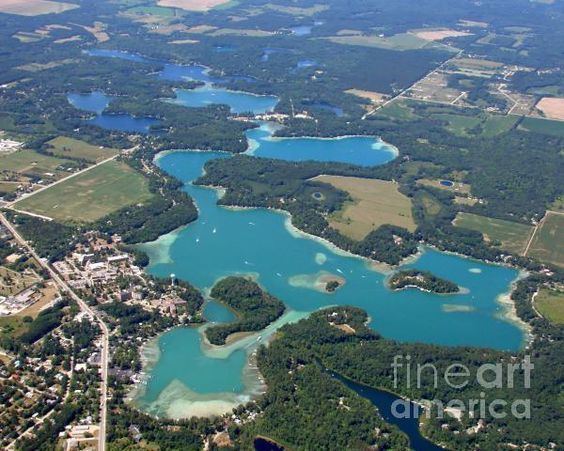
- Map of Waupaca WI 54981 USA
- History
- Geography
- Transportation
- Airport
- 2010 census
- 2000 census
- Business and industry
- References
Map of Waupaca, WI 54981, USA
The city is located mostly within the Town of Waupaca, though it is politically independent. A portion extends west into the adjacent Town of Farmington and there is also a noncontiguous area of the city in the Town of Lind to the south. The city is divided into natural areas, city areas, and industrial areas.
History
Native American mound builders lived in the area prior to European settlement. At one time there were 72 mounds n the area.
Waupaca was first settled in June 1849 by Capt. Augustus Hill Sr. and his sons, on a small waterfall along the Waupaca River. At the time, the area was home to the Menominee and Potowatomi tribes. The name for the settlement came either from the Indian term "waubuck seba," meaning pale water, or from a Potowatomi man named Sam Wapuka, or Chief Waupaca.
Waupaca was incorporated as a village on May 4, 1857 by act of the Wisconsin State Legislature. This act was repealed on April 7, 1862, but promptly revived on June 17 of the same year. Waupaca was incorporated as a city by the legislature on March 5, 1875. Beginning in the 1960s and continuing to the present, it has expanded through annexation.
Geography
Waupaca is located at 44°21′17″N 89°4′54″W (44.354922, -89.081775).
According to the United States Census Bureau, the city has a total area of 8.11 square miles (21.00 km2), of which, 7.82 square miles (20.25 km2) is land and 0.29 square miles (0.75 km2) is water.
Transportation
From 1899 to 1926 streetcar service was provided by the Waupaca Electric Light and Railway Company.
Airport
2010 census
As of the census of 2010, there were 6,069 people, 2,702 households, and 1,356 families residing in the city. The population density was 776.1 inhabitants per square mile (299.7/km2). There were 2,996 housing units at an average density of 383.1 per square mile (147.9/km2). The racial makeup of the city was 96.6% White, 0.9% African American, 0.7% Native American, 0.3% Asian, 0.5% from other races, and 1.0% from two or more races. Hispanic or Latino of any race were 2.3% of the population.
There were 2,702 households of which 25.9% had children under the age of 18 living with them, 34.9% were married couples living together, 10.9% had a female householder with no husband present, 4.4% had a male householder with no wife present, and 49.8% were non-families. 42.9% of all households were made up of individuals and 20.7% had someone living alone who was 65 years of age or older. The average household size was 2.10 and the average family size was 2.92.
The median age in the city was 40.1 years. 22.1% of residents were under the age of 18; 8.4% were between the ages of 18 and 24; 24.7% were from 25 to 44; 24.6% were from 45 to 64; and 20.1% were 65 years of age or older. The gender makeup of the city was 47.5% male and 52.5% female.
2000 census
At the 2000 census, there were 5,676 people, 2,364 households and 1,302 families residing in the city. The population density was 947.0 per square mile (365.9/km²). There were 2,543 housing units at an average density of 424.3 per square mile (163.9/km²). The racial makeup of the city was 96.26% White, 0.33% Black or African American, 0.86% Native American, 0.25% Asian, 0.02% Pacific Islander, 1.39% from other races, and 0.88% from two or more races. 3.42% of the population were Hispanic or Latino of any race.
There were 2,364 households of which 29.5% had children under the age of 18 living with them, 40.5% were married couples living together, 10.6% had a female householder with no husband present, and 44.9% were non-families. 38.1% of all households were made up of individuals and 18.2% had someone living alone who was 65 years of age or older. The average household size was 2.25 and the average family size was 3.01.
Age distribution was 25.4% under the age of 18, 9.5% from 18 to 24, 27.0% from 25 to 44, 17.9% from 45 to 64, and 20.2% who were 65 years of age or older. The median age was 36 years. For every 100 females there were 88.2 males. For every 100 females age 18 and over, there were 84.9 males.
The median household income was $31,095, and the median family income was $45,128. Males had a median income of $32,488 versus $21,651 for females. The per capita income for the city was $18,890. About 7.1% of families and 10.5% of the population were below the poverty line, including 12.9% of those under age 18 and 12.0% of those age 65 or over.
Business and industry
The Waupaca Foundry is the largest employer in the city, employing over 1500 workers in three plants in or around the city. Most of the employees live within 20 miles (32 km) of the city. Gusmer Enterprises, Inc., with a manufacturing plant on Ware Street, produces products for the food and beverage, industrial and pharmaceutical markets.