
Country United States County Adair FIPS code 40-79150 Elevation 250 m Population 345 (2010) | Time zone Central (CST) (UTC-6) GNIS feature ID 2584395 Local time Sunday 8:13 AM | |
 | ||
Weather 17°C, Wind S at 21 km/h, 75% Humidity Area 20.54 km² (20.46 km² Land / 10 ha Water) | ||
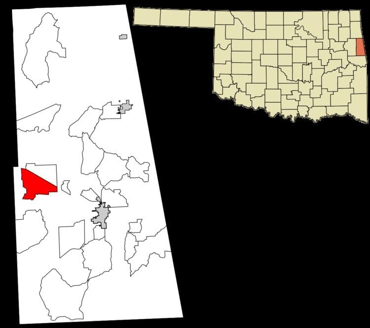
Wauhillau is a census-designated place (CDP) in Adair County, Oklahoma, United States. The population was 345 at the 2010 census.
Contents
Map of Wauhillau, OK 74471, USA
Geography
Wauhillau occupies a large rural area in western Adair County and is centered at 35°51′25″N 94°46′23″W. Oklahoma State Highway 51 forms the northeastern edge of the CDP. It is 11 miles (18 km) west of Stilwell, the county seat, and 16 miles (26 km) southeast of Tahlequah in Cherokee County.
According to the United States Census Bureau, the CDP has a total area of 7.93 square miles (20.55 km2), of which 7.90 square miles (20.45 km2) is land and 0.039 square miles (0.10 km2), or 0.48%, is water.
References
Wauhillau, Oklahoma Wikipedia(Text) CC BY-SA