
Country United States FIPS code 31-51665 Elevation 344 m Zip code 68069 Local time Sunday 5:42 AM | Time zone Central (CST) (UTC-6) GNIS feature ID 0834501 Area 168 ha Population 866 (2013) Area code 402 | |
 | ||
Weather 14°C, Wind SE at 6 km/h, 91% Humidity | ||
Waterloo nebraska snow
Waterloo is a village in Douglas County, Nebraska, United States. The population was 848 at the 2010 census.
Contents
- Waterloo nebraska snow
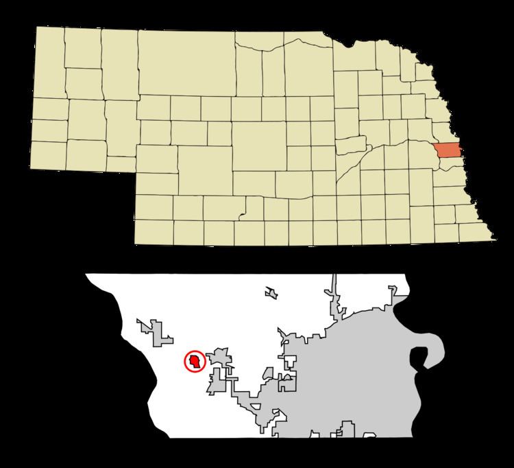
- Map of Waterloo NE 68069 USA
- Us highway 275 west in waterloo nebraska
- History
- Geography
- 2010 census
- 2000 census
- Notable people
- References
Map of Waterloo, NE 68069, USA
Us highway 275 west in waterloo nebraska
History
Waterloo was founded in about 1870 when the Union Pacific Railroad was extended to that point. The name commemorates the Battle of Waterloo.
Geography
Waterloo is located at 41°17′13″N 96°17′18″W (41.287021, -96.288387).
According to the United States Census Bureau, the village has a total area of 0.65 square miles (1.68 km2), all of it land.
2010 census
As of the census of 2010, there were 848 people, 337 households, and 229 families residing in the village. The population density was 1,304.6 inhabitants per square mile (503.7/km2). There were 359 housing units at an average density of 552.3 per square mile (213.2/km2). The racial makeup of the village was 95.9% White, 0.6% African American, 1.2% Native American, 1.1% from other races, and 1.3% from two or more races. Hispanic or Latino of any race were 6.5% of the population.
There were 337 households of which 30.6% had children under the age of 18 living with them, 57.0% were married couples living together, 8.0% had a female householder with no husband present, 3.0% had a male householder with no wife present, and 32.0% were non-families. 27.0% of all households were made up of individuals and 9.5% had someone living alone who was 65 years of age or older. The average household size was 2.52 and the average family size was 3.09.
The median age in the village was 38.9 years. 26.7% of residents were under the age of 18; 6.9% were between the ages of 18 and 24; 25.8% were from 25 to 44; 28.1% were from 45 to 64; and 12.5% were 65 years of age or older. The gender makeup of the village was 49.8% male and 50.2% female.
2000 census
As of the census of 2000, there were 459 people, 183 households, and 124 families residing in the village. The population density was 1,292.7 people per square mile (492.3/km²). There were 190 housing units at an average density of 535.1 per square mile (203.8/km²). The racial makeup of the village was 98.69% White, 0.87% from other races, and 0.44% from two or more races. Hispanic or Latino of any race were 2.61% of the population.
There were 183 households out of which 30.6% had children under the age of 18 living with them, 60.7% were married couples living together, 4.4% had a female householder with no husband present, and 31.7% were non-families. 27.9% of all households were made up of individuals and 9.8% had someone living alone who was 65 years of age or older. The average household size was 2.51 and the average family size was 3.12.
In the village, the population was spread out with 28.1% under the age of 18, 6.1% from 18 to 24, 26.6% from 25 to 44, 26.1% from 45 to 64, and 13.1% who were 65 years of age or older. The median age was 40 years. For every 100 females there were 100.4 males. For every 100 females age 18 and over, there were 98.8 males.
As of 2000 the median income for a household in the village was $45,625, and the median income for a family was $55,156. Males had a median income of $36,875 versus $21,827 for females. The per capita income for the village was $19,089. None of the families and 1.4% of the population were living below the poverty line, including no under eighteens and 2.3% of those over 64.