
Country Japan District Watarai Area 135 km² Local time Sunday 3:03 PM | Region Kansai Phone number 0596-52-7111 Population 8,534 (Sep 2012) Prefecture Mie Prefecture | |
 | ||
Time zone Japan Standard Time (UTC+9) Address 1215-1 Tanahashi, Watarai-chō, Watarai-gun, Mie-ken 516-2103 Weather 20°C, Wind NW at 32 km/h, 67% Humidity | ||
Watarai (度会町, Watarai-chō) is a town located in Watarai District, Mie Prefecture, Japan. As of September 2012, the town had an estimated population of 8,534 and a population density of 63.2 persons per km². The total area was 134.97 km².
Contents
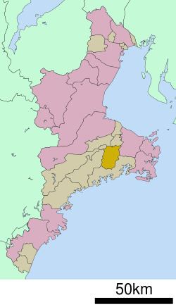
- Map of Watarai Watarai District Mie Prefecture Japan
- Geography
- Adjacent municipalities
- History
- Economy
- Transportation
- References
Map of Watarai, Watarai District, Mie Prefecture, Japan
Geography
Watarai is an inland municipality, located in eastern Kii Peninsula, near the geographic center of Mie Prefecture.
Adjacent municipalities
History
Watari Village was established on April 1, 1955 through the merger of four villages in Watarai District. Watarai was elevated to town status on January 1, 1968.
Economy
The town serves as a commercial center for the surrounding region.
Transportation
Watarai is not served by any rail service, nor does any national highway pass through the town.
References
Watarai, Mie Wikipedia(Text) CC BY-SA