
Airport type Public 15/33 5,000 Elevation 102 m | Elevation AMSL 336 ft / 102 m 5,000 1,524 Aircraft operations 42,184 Phone +1 540-422-8285 | |
 | ||
Address 5075 Airport Rd, Midland, VA 22728, USA Similar Messick's Farm Market, Fauquier Times, Culpeper Regional Airport, Manassas Regional Airport, Weichert Realtors | ||
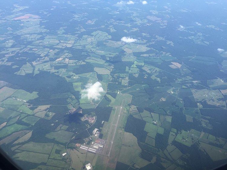
Warrenton–Fauquier Airport (ICAO: KHWY, FAA LID: HWY, formerly W66) is a county-owned, public-use airport located 12 nautical miles (22 km) southeast of the central business district of Warrenton, a town in Fauquier County, Virginia, United States.
Although most U.S. airports use the same three-letter location identifier for the FAA and IATA, this airport is assigned HWY by the FAA but has no designation from the IATA.
Facilities and aircraft
Warrenton–Fauquier Airport covers an area of 407 acres (165 ha) at an elevation of 336 feet (102 m) above mean sea level. It has one runway designated 15/33 with a 5,000 x 100 ft (1,524 x 30 m) asphalt surface.
For the 12-month period ending June 29, 2007, the airport had 42,184 aircraft operations, an average of 115 per day: 98% general aviation, 1% air taxi and <1% military. At that time there were 119 aircraft based at this airport: 84% single-engine (100), 13% multi-engine, 3% ultralight and 1% helicopter.