
Population 80 Sovereign state United Kingdom Local time Saturday 9:47 PM | OS grid reference SY753858 | |
 | ||
Weather 10°C, Wind E at 11 km/h, 80% Humidity | ||
Warmwell is a small village and civil parish in south west Dorset, England, situated on the B3390 road about 5 miles (8.0 km) southeast of Dorchester. In 2013 the estimated population of the parish was 80.
Map of Warmwell, Dorchester, UK
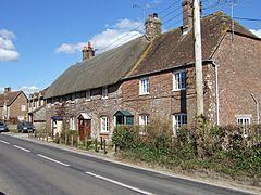
Warmwell contains several historic buildings, including a Jacobean manor house, and from May 1937 was the home of RAF Station Woodsford airfield (later renamed RAF Warmwell), which is now a popular holiday site and contains a caravan park and several other small businesses.
References
Warmwell Wikipedia(Text) CC BY-SA