
Country United States ZIP codes 29669 Area 237 ha Population 228 (2010) | Time zone Eastern (EST) (UTC-5) FIPS code 45045 Local time Sunday 10:01 PM | |
 | ||
Weather 16°C, Wind S at 5 km/h, 41% Humidity | ||
Ware Place is a Census-designated place located in Greenville County in the U.S. State of South Carolina. According to the 2010 United States Census, the population was 228.
Contents
Map of Ware Place, SC 29669, USA
Geography
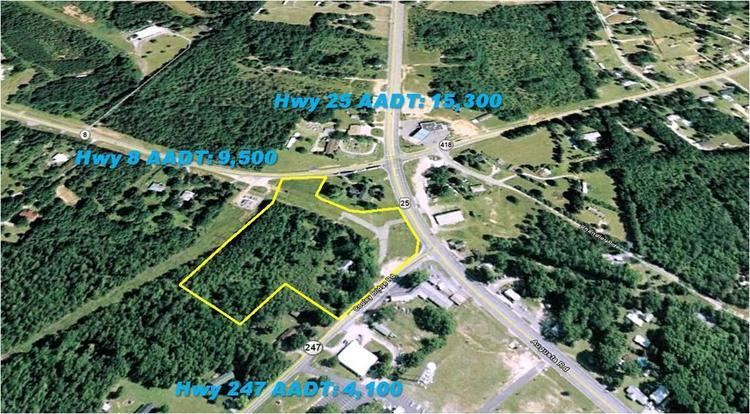
Ware Place is located at 34°37′40″N 82°23′27″W (34.624718, -82.384822). These coordinates place the CDP on the southwestern side of the county, near the border with Anderson County.
According to the United States Census Bureau, the CDP has a total land area of 0.917 square mile (2.37 km²) and a total water area of 0.001 square mile (0.003 km²).
References
Ware Place, South Carolina Wikipedia(Text) CC BY-SA