
Population 32 2001 Census Unitary authority Area 3.03 km² | OS grid reference SK830003 Local time Monday 2:47 AM Postcode district LE15 | |
 | ||
Weather 8°C, Wind NW at 21 km/h, 78% Humidity | ||
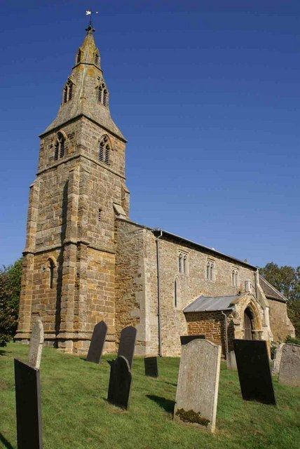
Wardley is a village and civil parish in the county of Rutland in the East Midlands of England. The population at the 2001 census was 32. At the 2011 census the population remained less than 100 and is included in the civil parish of Ridlington. It is located about two miles (3 km) west of Uppingham, close to the A47. The two-mile (3 km) £1.9 million Wardley Hill Improvement opened in October 1987 when the road through the village became a dead end. The parish church, dedicated to St Botolph, is Grade II* listed. In 2016 the church passed into the care of the Churches Conservation Trust.
Map of Wardley, UK
The village has no mains water supply, instead water is supplied from a borehole.
Wardley Wood, owned by the Forestry Commission, is an ancient woodland on a hillside.