
Time zone CST (UTC+8) Subdivision 6 Villages Population 6,530 (Dec 2014) Province Taiwan Province | Region Eastern Taiwan Post code 979 Area 618.5 km² Local time Monday 5:17 AM | |
 | ||
Weather 23°C, Wind W at 10 km/h, 62% Humidity | ||
Wanrong Township or Wanrung Township (Chinese: 萬榮鄉; pinyin: Wànróng Xiāng) is a mountain indigenous township located in the west of Hualien County, Taiwan, and has a population of 6,530 inhabitants and 8 villages.
Contents
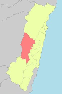
- Map of Wanrong Township Hualien County Taiwan 979
- Administrative divisions
- Tourist attractions
- Transportation
- References
Map of Wanrong Township, Hualien County, Taiwan 979
The altitude and climates change greatly with the mountains of Central Range, and the adverse altitude is about 600 m. The main inhabitants are Truku people, Bunun people and Atayal people of the Taiwanese aborigines, and most economic activity is agriculture, which located in the small plain near Fenglin Township. The abundant resources of tourism has not been developed.
Administrative divisions
The township comprises six villages: Hongye, Jianqing, Mayuan, Mingli, Wanrong and Xilin.
Tourist attractions
Transportation
References
Wanrong, Hualien Wikipedia(Text) CC BY-SA