
 | ||
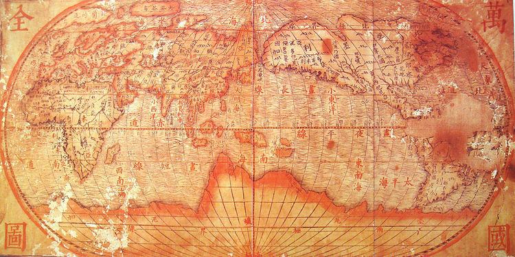
The Wanguo Quantu (萬國全圖, lit. "Complete map of all the countries") is a type of map that was developed by the Jesuits in the 1620s, within the context of the Jesuit China Missions.
Development
The Wanguo Quantu map was developed in the 1620s by the Jesuit Giulio Aleni following the earlier work of Matteo Ricci, who was the first Jesuit to speak Chinese and to publish maps of the world in China from 1574 to 1603. Aleni modified Ricci's maps by responding to Chinese demands to have the Chinese Empire located at the center of the world map, resulting in the Sino-centric configuration of the Wanguo Quantu.
References
Wanguo Quantu Wikipedia(Text) CC BY-SA