
Postcode(s) 2840 Mean max temp Mean min temp 28.0 °C 12.9 °C Elevation 110 m Population 195 (2011 census) | Mean min temp Annual rainfall 12.9 °C 276 mm Postal code 2840 Local time Sunday 6:03 PM | |
 | ||
Weather 24°C, Wind S at 31 km/h, 27% Humidity | ||
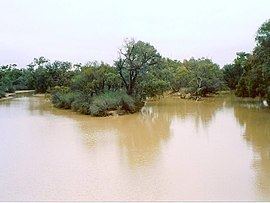
Wanaaring is a village in north western New South Wales, Australia. Situated on the Paroo River, some 980 kilometres from Sydney, and 180 km west of Bourke. At the 2011 census, Wanaaring had a population of 195.
Contents
Map of Wanaaring NSW 2840, Australia
Wanaaring is on the "Cut Line" road between the town of Bourke, and the desert village of Tibooburra. Long distance travellers often stop at Wanaaring for meals or to refuel.
Wanaaring is in outback Australia, in remote agricultural country. The grazing lands support cattle, sheep and goats. Honey is also produced. An all-weather air strip is located east of the village centre.
Activities
Fishing and bush camping by the Paroo River. There is an annual gymkhana and rodeo, which supports the Royal Flying Doctor Service. The Flying Doctor provides essential medical aid to outback communities such as Wanaaring.
Climate
The climate is semi-arid, featuring low rainfall, very hot summer temperatures and cool nights in winter. A minimum temperature of -3.9 oC was recorded in July 1997.