
Country United States County Harvey Time zone CST (UTC-6) Area 93 ha Zip code 67151 Local time Saturday 10:34 PM | Platted 1871 FIPS code 20-75200 Elevation 468 m Population 233 (2013) Area code 620 | |
 | ||
Weather 21°C, Wind S at 29 km/h, 71% Humidity | ||
Walton is a city in Harvey County, Kansas, United States. It is named in honor of one of the 19th century stockholders of Atchison, Topeka and Santa Fe Railway. As of the 2010 census, the city population was 235.
Contents
- Map of Walton KS USA
- Early history
- 19th century
- 20th century
- Geography
- Area events
- Area attractions
- 2010 census
- 2000 census
- Government
- Primary and secondary education
- Library
- Film
- Radio
- Television
- Transportation
- Utilities
- Notable people
- References
Map of Walton, KS, USA
Early history
For many millennia, the Great Plains of North America was inhabited by nomadic Native Americans. From the 16th century to 18th century, the Kingdom of France claimed ownership of large parts of North America. In 1762, after the French and Indian War, France secretly ceded New France to Spain, per the Treaty of Fontainebleau.
19th century
In 1802, Spain returned most of the land to France. In 1803, most of the land for modern day Kansas was acquired by the United States from France as part of the 828,000 square mile Louisiana Purchase for 2.83 cents per acre.
In 1854, the Kansas Territory was organized, then in 1861 Kansas became the 34th U.S. state. In 1872, Harvey County was established within the Kansas Territory, which included the land for modern day Walton.
In 1871, the Atchison, Topeka and Santa Fe Railway extended a main line from Emporia through Walton to Newton. In 1996, it merged with Burlington Northern Railroad and renamed to the current BNSF Railway. Most locals still refer to this railroad as the "Santa Fe".
Walton was laid out as a town site in December 1871 by William Mathews. He built a home and this was followed by a general store and railroad section house. Because of difficulty in perfecting title to the lots, the town-site remained dormant until it was sold to J.F. Watson and he filed a plat of the town in 1876. In 1871 a Kansas one room school, measuring 18 x 20 feet, was built and the first school was held by Mrs. M. J. Sharron. A post office was established in Walton on December 28, 1871, Mrs. E. Peck as Postmistress.
20th century
The New Santa Fe Trail road was routed through Walton in the late 1910s. Initially the road entered the north side of the city on Walton Ave. The trail became U.S. Route 50 in the late 1930s when the new highway was routed northeast to southwest parallel to the railroad.
Geography
Walton is located at 38°7′4″N 97°15′24″W (38.117601, -97.256478), and being near the divide between Cottonwood and Arkansas Rivers and highest ground in Harvey County. According to the United States Census Bureau, the city has a total area of 0.36 square miles (0.93 km2), all of it land.
Area events
Area attractions
2010 census
As of the census of 2010, there were 235 people, 93 households, and 69 families residing in the city. The population density was 652.8 inhabitants per square mile (252.0/km2). There were 105 housing units at an average density of 291.7 per square mile (112.6/km2). The racial makeup of the city was 93.2% White, 0.4% African American, 5.1% Native American, 0.4% Asian, and 0.9% from two or more races. Hispanic or Latino of any race were 6.0% of the population.
There were 93 households of which 30.1% had children under the age of 18 living with them, 58.1% were married couples living together, 10.8% had a female householder with no husband present, 5.4% had a male householder with no wife present, and 25.8% were non-families. 23.7% of all households were made up of individuals and 9.7% had someone living alone who was 65 years of age or older. The average household size was 2.53 and the average family size was 2.88.
The median age in the city was 40.9 years. 21.7% of residents were under the age of 18; 8.5% were between the ages of 18 and 24; 21.7% were from 25 to 44; 30.7% were from 45 to 64; and 17.4% were 65 years of age or older. The gender makeup of the city was 57.0% male and 43.0% female.
2000 census
As of the census of 2000, there were 284 people, 109 households, and 79 families residing in the city. The population density was 1,162.6 people per square mile (456.9/km²). There were 118 housing units at an average density of 483.1 per square mile (189.8/km²). The racial makeup of the city was 95.42% White, 1.41% African American, 1.06% Native American, 1.06% from other races, and 1.06% from two or more races. Hispanic or Latino of any race were 3.87% of the population.
There were 109 households out of which 42.2% had children under the age of 18 living with them, 56.0% were married couples living together, 10.1% had a female householder with no husband present, and 27.5% were non-families. 23.9% of all households were made up of individuals and 7.3% had someone living alone who was 65 years of age or older. The average household size was 2.61 and the average family size was 3.10.
In the city, the population was spread out with 32.0% under the age of 18, 8.5% from 18 to 24, 33.8% from 25 to 44, 16.9% from 45 to 64, and 8.8% who were 65 years of age or older. The median age was 31 years. For every 100 females there were 129.0 males. For every 100 females age 18 and over, there were 114.4 males.
As of 2000 the median income for a household was $34,375, and the median income for a family was $39,500. Males had a median income of $30,781 versus $18,882 for females. The per capita income for the city was $16,679. About 9.1% of families and 11.1% of the population were below the poverty line, including 16.5% of those under the age of eighteen and none of those sixty five or over.
Government
The Walton government consists of a mayor and five council members. The council meets the 1st Monday of each month at 7PM.
Primary and secondary education
Walton is part of Unified School District 373. Walton students of junior and high school ages attend school in Newton.
Walton High School was closed through school unification. The Walton High School mascot was Walton Wildcats.
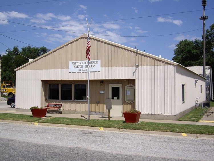
Library
Film
Using Agriculture to Spur Achievement : The Walton 21st Century Rural Life Center, 2011, U.S. Department of Education filmed a documentary at the Walton 21st Century Rural Life Center charter elementary school in November 2010. The crew also interviewed farm families, teachers, students, and community members. The resulting video will be featured on their website, highlighting the center as a best practices model of innovation in education.
Radio
Walton is served by numerous radio stations of the Wichita-Hutchinson listening market area, and satellite radio. See Media in Wichita, Kansas.
Television
Walton is served by over-the-air ATSC digital TV of the Wichita-Hutchinson viewing market area, cable TV, and satellite TV. See Media in Wichita, Kansas.
Transportation
A major highway US-50 and a railroad BNSF Railway pass through Walton. US-50 was originally the New Santa Fe Trail and roughly parallels the BNSF Railway.
The Amtrak Southwest Chief stops in nearby Newton twice each day and provides passenger rail service towards Los Angeles and Chicago. See Newton (Amtrak station).