
 | ||
Similar Wadi Qelt, Wadi Murabba'at, Nachal Arugot, Pa'ar Cave, Wadi Sdeir | ||
Wadi Og (Hebrew: נחל אוג, Arabic: وادي مكلك) is a winterbourne stream near the kibbutz and Israeli settlement Almog. It runs for 30 km from Jerusalem till the Dead Sea.
Map of Nahal Og
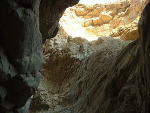
Wadi Og is the northernmost of the streams that flow from the Judaean Desert into the Dead Sea. The stream drains the slopes of the Mount of Olives, Mount Scopus and Abu Dis in Jerusalem at 800 m above sea level and descends till the Dead Sea at 400 m below sea level. The steepness of the stream results in heavy flooding during the winter, and in the past, parts of Highway 90 have been swept away. The stream sweeps mud and debris along with the water and sometimes during flooding times it is possible to see a trail of mud, hundreds of meters long, in the waters of the Dead Sea. The stream also passes by Nabi Musa. At the end of the stream, a reservoir was built which stores waters from the floods and is used by Almog.
The name of the stream is derived from the local sumac plant (Rhus tripartita), that grows in the wadi, which is named Og in Hebrew.